

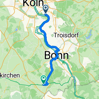
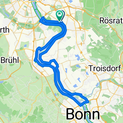
Eil/Heiligenhaus
A cycling route starting in Gremberghoven, North Rhine-Westphalia, Germany.
Overview
About this route
- -:--
- Duration
- 51.2 km
- Distance
- 283 m
- Ascent
- 283 m
- Descent
- ---
- Avg. speed
- ---
- Max. altitude

Route quality
Waytypes & surfaces along the route
Waytypes
Path
8.7 km
(17 %)
Road
5.6 km
(11 %)
Surfaces
Paved
48.6 km
(95 %)
Unpaved
0.5 km
(1 %)
Asphalt
48.6 km
(95 %)
Unpaved (undefined)
0.5 km
(1 %)
Undefined
2 km
(4 %)
Continue with Bikemap
Use, edit, or download this cycling route
You would like to ride Eil/Heiligenhaus or customize it for your own trip? Here is what you can do with this Bikemap route:
Free features
- Save this route as favorite or in collections
- Copy & plan your own version of this route
- Sync your route with Garmin or Wahoo
Premium features
Free trial for 3 days, or one-time payment. More about Bikemap Premium.
- Navigate this route on iOS & Android
- Export a GPX / KML file of this route
- Create your custom printout (try it for free)
- Download this route for offline navigation
Discover more Premium features.
Get Bikemap PremiumFrom our community
Other popular routes starting in Gremberghoven
 Rund um Bergisch Gladbach 60
- Distance
- 58.6 km
- Ascent
- 302 m
- Descent
- 302 m
- Location
- Gremberghoven, North Rhine-Westphalia, Germany
 Autp
Autp- Distance
- 5.1 km
- Ascent
- 6 m
- Descent
- 9 m
- Location
- Gremberghoven, North Rhine-Westphalia, Germany
 Rund um Bergisch Gladbach 60
- Distance
- 58.9 km
- Ascent
- 306 m
- Descent
- 308 m
- Location
- Gremberghoven, North Rhine-Westphalia, Germany
 Elisenstraße 50A nach Bonner Straße
- Distance
- 45.7 km
- Ascent
- 258 m
- Descent
- 141 m
- Location
- Gremberghoven, North Rhine-Westphalia, Germany
 Porz-Bonn-Wesseling-Porz
- Distance
- 62 km
- Ascent
- 69 m
- Descent
- 71 m
- Location
- Gremberghoven, North Rhine-Westphalia, Germany
 Eil/Heiligenhaus
- Distance
- 51.2 km
- Ascent
- 283 m
- Descent
- 283 m
- Location
- Gremberghoven, North Rhine-Westphalia, Germany
 Köln - Langenfeld Kurzestrecke
- Distance
- 27.1 km
- Ascent
- 54 m
- Descent
- 51 m
- Location
- Gremberghoven, North Rhine-Westphalia, Germany
 Gremberghoven - Alfter
- Distance
- 29.3 km
- Ascent
- 72 m
- Descent
- 40 m
- Location
- Gremberghoven, North Rhine-Westphalia, Germany
Open it in the app