

Schöne Strecke bei heißem Wetter
A cycling route starting in Eltville, Hesse, Germany.
Overview
About this route
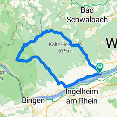
The route gently climbs up to Bärstadt. At forest junctions, always go straight or uphill, then you reach the road above Bärstadt leading to Hausen. Enjoy the fast descent to Kiedrich and join the R3a which goes via Kloster Eberbach and the Steinberg State Domain to Hallgarten and Johannisberg. Descend towards Geisenheim and then return directly along the Rhine (underpasses) or use the parallel road to the B42.
- -:--
- Duration
- 51.1 km
- Distance
- 589 m
- Ascent
- 589 m
- Descent
- ---
- Avg. speed
- ---
- Max. altitude
Route quality
Waytypes & surfaces along the route
Waytypes
Track
16.3 km
(32 %)
Quiet road
8.7 km
(17 %)
Surfaces
Paved
37.8 km
(74 %)
Unpaved
8.7 km
(17 %)
Asphalt
37.8 km
(74 %)
Gravel
7.2 km
(14 %)
Continue with Bikemap
Use, edit, or download this cycling route
You would like to ride Schöne Strecke bei heißem Wetter or customize it for your own trip? Here is what you can do with this Bikemap route:
Free features
- Save this route as favorite or in collections
- Copy & plan your own version of this route
- Sync your route with Garmin or Wahoo
Premium features
Free trial for 3 days, or one-time payment. More about Bikemap Premium.
- Navigate this route on iOS & Android
- Export a GPX / KML file of this route
- Create your custom printout (try it for free)
- Download this route for offline navigation
Discover more Premium features.
Get Bikemap PremiumFrom our community
Other popular routes starting in Eltville
 Kalte Herberge Runde 1
- Distance
- 24.1 km
- Ascent
- 569 m
- Descent
- 568 m
- Location
- Eltville, Hesse, Germany
 Eltville -> Frauenstein -> Hohe Wurzel -> Rauenthal
- Distance
- 35.8 km
- Ascent
- 670 m
- Descent
- 580 m
- Location
- Eltville, Hesse, Germany
 18.08.09
- Distance
- 58.4 km
- Ascent
- 1,158 m
- Descent
- 1,156 m
- Location
- Eltville, Hesse, Germany
 RTF Eltville 2009
- Distance
- 108.1 km
- Ascent
- 1,598 m
- Descent
- 1,375 m
- Location
- Eltville, Hesse, Germany
 Easy ride in Eltville
- Distance
- 41.7 km
- Ascent
- 238 m
- Descent
- 229 m
- Location
- Eltville, Hesse, Germany
 Eltville -> Georgenborn -> Hausen
- Distance
- 37.8 km
- Ascent
- 711 m
- Descent
- 704 m
- Location
- Eltville, Hesse, Germany
 Eltville - Niedergladbach - Eltville
- Distance
- 47.6 km
- Ascent
- 950 m
- Descent
- 933 m
- Location
- Eltville, Hesse, Germany
 Schöne Strecke bei heißem Wetter
- Distance
- 51.1 km
- Ascent
- 589 m
- Descent
- 589 m
- Location
- Eltville, Hesse, Germany
Open it in the app