
2009 Euro Tour -- Ride Day 14 — 7 July 2009 — 21850 St-Apollinaire (Dijon) -- Circle
A cycling route starting in Saint-Apollinaire, Bourgogne-Franche-Comté, France.
Overview
About this route
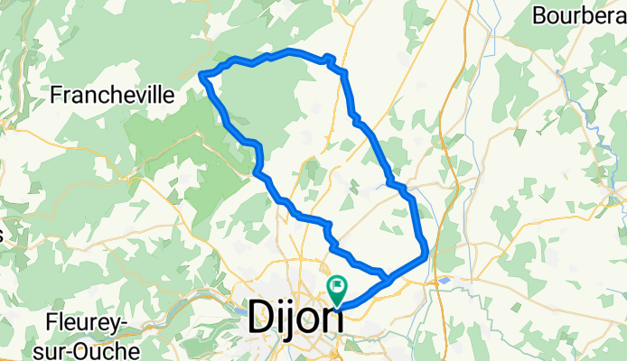
We decided to extend two more nights in Dijon so we had a great ride to the area north of the city. Fortunately, despite the glowing weather report, we took along our coats and rain booties since we ended up getting rained on some. Nothing like the drenching we had earlier this trip, but enough to get us pretty wet.<br /> <br />Along this route, the long 9 km climb up D996 of about 300 M to 554 M was definitely a good training section.<br /> <br />On the way back, we were able to use our knowledge gained from getting lost yesterday to find the Carrefour easily. That allowed us to easily buy food for dinner and the next few days. Last night, we’d had a somewhat sparse dinner in the room consuming all the food we’d had left. As we arrived pretty late after all the time spent pedaling around Dijon, we hadn’t had time to get to a store for anything.<br /><br />Background:<br /> <br />My wife and I have been doing self-supported tours in Western Europe (a majority in France) since 1993. This series of rides covers our 2009 4.5 month route through parts of France, Germany, Austria, Switzerland, and then back to France. Our beginning and ending point is near Chadurie (south of Angouleme) where our friends have a farm with Gites and Chambres d'Hotes.<br /><br />We rode our Dawes touring bicycles purchased in 1993 heavily loaded with 700Cx32 tires. All of our riding was on paved roads, mostly with very little traffic. Pretty much the only unpaved sections were some bicycle paths in Germany and Austria. Sadly, that wasn't so great as Helen fell a number of times on the unpaved paths. Fortunately, though, no serious injury.<br /><br />If any questions, feel free to email me at jeffkadet@netdiving.com<br /><br />Jeff<br />
- -:--
- Duration
- 60.6 km
- Distance
- 461 m
- Ascent
- 460 m
- Descent
- ---
- Avg. speed
- ---
- Avg. speed

Route quality
Waytypes & surfaces along the route
Waytypes
Busy road
26.1 km
(43 %)
Road
17.5 km
(29 %)
Surfaces
Paved
29 km
(48 %)
Asphalt
29 km
(48 %)
Undefined
31.7 km
(52 %)
Continue with Bikemap
Use, edit, or download this cycling route
You would like to ride 2009 Euro Tour -- Ride Day 14 — 7 July 2009 — 21850 St-Apollinaire (Dijon) -- Circle or customize it for your own trip? Here is what you can do with this Bikemap route:
Free features
- Save this route as favorite or in collections
- Copy & plan your own version of this route
- Sync your route with Garmin or Wahoo
Premium features
Free trial for 3 days, or one-time payment. More about Bikemap Premium.
- Navigate this route on iOS & Android
- Export a GPX / KML file of this route
- Create your custom printout (try it for free)
- Download this route for offline navigation
Discover more Premium features.
Get Bikemap PremiumFrom our community
Other popular routes starting in Saint-Apollinaire
 Dijon Turcey Bussy Pasques Dijon
- Distance
- 100.2 km
- Ascent
- 750 m
- Descent
- 750 m
- Location
- Saint-Apollinaire, Bourgogne-Franche-Comté, France
 Bignol 42 km
- Distance
- 42 km
- Ascent
- 286 m
- Descent
- 283 m
- Location
- Saint-Apollinaire, Bourgogne-Franche-Comté, France
 • Dijon_links zum Kanal 19 km, abends Theater
- Distance
- 19.9 km
- Ascent
- 96 m
- Descent
- 99 m
- Location
- Saint-Apollinaire, Bourgogne-Franche-Comté, France
 DIJON - CHAMPS /Marne
- Distance
- 447 km
- Ascent
- 367 m
- Descent
- 572 m
- Location
- Saint-Apollinaire, Bourgogne-Franche-Comté, France
 2009 Euro Tour -- Ride Day 14 — 7 July 2009 — 21850 St-Apollinaire (Dijon) -- Circle
- Distance
- 60.6 km
- Ascent
- 461 m
- Descent
- 460 m
- Location
- Saint-Apollinaire, Bourgogne-Franche-Comté, France
 Petit tour
- Distance
- 33.5 km
- Ascent
- 313 m
- Descent
- 315 m
- Location
- Saint-Apollinaire, Bourgogne-Franche-Comté, France
 Dijon_links zum Kanal 50 km
- Distance
- 50.8 km
- Ascent
- 295 m
- Descent
- 291 m
- Location
- Saint-Apollinaire, Bourgogne-Franche-Comté, France
 Le Tour De France: Stage 7
- Distance
- 177.9 km
- Ascent
- 215 m
- Descent
- 240 m
- Location
- Saint-Apollinaire, Bourgogne-Franche-Comté, France
Open it in the app