

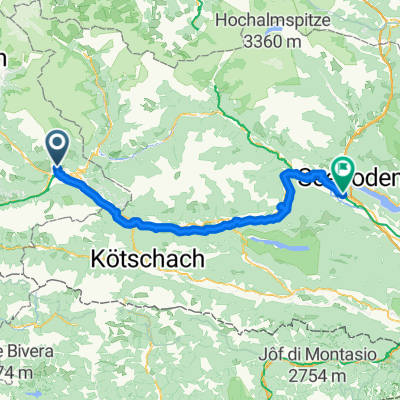
46.842, 12.771 nach 46.636, 14.150
A cycling route starting in Thurn, Tyrol, Austria.
Overview
About this route
- 7 h 52 min
- Duration
- 144.8 km
- Distance
- 1,322 m
- Ascent
- 874 m
- Descent
- 18.4 km/h
- Avg. speed
- 725 m
- Max. altitude
Route quality
Waytypes & surfaces along the route
Waytypes
Quiet road
42 km
(29 %)
Track
34.8 km
(24 %)
Surfaces
Paved
95.6 km
(66 %)
Unpaved
30.4 km
(21 %)
Asphalt
94.1 km
(65 %)
Gravel
30.4 km
(21 %)
Continue with Bikemap
Use, edit, or download this cycling route
You would like to ride 46.842, 12.771 nach 46.636, 14.150 or customize it for your own trip? Here is what you can do with this Bikemap route:
Free features
- Save this route as favorite or in collections
- Copy & plan your own version of this route
- Split it into stages to create a multi-day tour
- Sync your route with Garmin or Wahoo
Premium features
Free trial for 3 days, or one-time payment. More about Bikemap Premium.
- Navigate this route on iOS & Android
- Export a GPX / KML file of this route
- Create your custom printout (try it for free)
- Download this route for offline navigation
Discover more Premium features.
Get Bikemap PremiumFrom our community
Other popular routes starting in Thurn
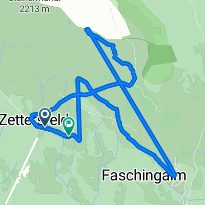
 Zettersfeld - Iselsberg - Pusarnitz
- Distance
- 75.7 km
- Ascent
- 1,084 m
- Descent
- 2,274 m
- Location
- Thurn, Tyrol, Austria
 46.842, 12.771 nach 46.636, 14.150
- Distance
- 144.8 km
- Ascent
- 1,322 m
- Descent
- 874 m
- Location
- Thurn, Tyrol, Austria
 20180227_104059.gpx
- Distance
- 7.9 km
- Ascent
- 692 m
- Descent
- 727 m
- Location
- Thurn, Tyrol, Austria
 Dolomiten Radweg (extended) Lienz - Innsbruck
- Distance
- 591.3 km
- Ascent
- 3,678 m
- Descent
- 3,898 m
- Location
- Thurn, Tyrol, Austria
 E2 Lienz-Spittal
- Distance
- 82.6 km
- Ascent
- 789 m
- Descent
- 955 m
- Location
- Thurn, Tyrol, Austria
 Zettersfeldstraße do Zettersfeldstraße
- Distance
- 101.9 km
- Ascent
- 1,514 m
- Descent
- 1,514 m
- Location
- Thurn, Tyrol, Austria
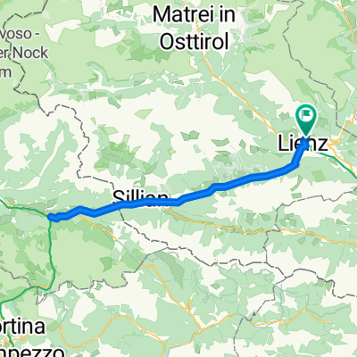
 Thurn - Oberlienz
- Distance
- 31.3 km
- Ascent
- 896 m
- Descent
- 1,547 m
- Location
- Thurn, Tyrol, Austria
 Ost-Tirol: Rundtour über Lesach-Tal
- Distance
- 116.3 km
- Ascent
- 1,368 m
- Descent
- 1,366 m
- Location
- Thurn, Tyrol, Austria
Open it in the app