

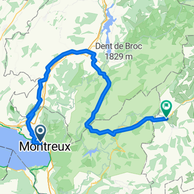
Marly - Montreux
A cycling route starting in Le Châtelard, Canton of Vaud, Switzerland.
Overview
About this route
- -:--
- Duration
- 160.8 km
- Distance
- 3,128 m
- Ascent
- 2,925 m
- Descent
- ---
- Avg. speed
- ---
- Max. altitude

Route quality
Waytypes & surfaces along the route
Waytypes
Road
48.2 km
(30 %)
Quiet road
38.6 km
(24 %)
Surfaces
Paved
82 km
(51 %)
Unpaved
4.8 km
(3 %)
Asphalt
74 km
(46 %)
Paved (undefined)
4.8 km
(3 %)
Route highlights
Points of interest along the route
Point of interest after 14.6 km
Col de Jaman
Point of interest after 40.6 km
Col de Soladier
Point of interest after 60 km
Les Alpettes
Point of interest after 108.6 km
Euschelspass
Continue with Bikemap
Use, edit, or download this cycling route
You would like to ride Marly - Montreux or customize it for your own trip? Here is what you can do with this Bikemap route:
Free features
- Save this route as favorite or in collections
- Copy & plan your own version of this route
- Split it into stages to create a multi-day tour
- Sync your route with Garmin or Wahoo
Premium features
Free trial for 3 days, or one-time payment. More about Bikemap Premium.
- Navigate this route on iOS & Android
- Export a GPX / KML file of this route
- Create your custom printout (try it for free)
- Download this route for offline navigation
Discover more Premium features.
Get Bikemap PremiumFrom our community
Other popular routes starting in Le Châtelard
 From Montreux to Saanen
- Distance
- 82.5 km
- Ascent
- 1,736 m
- Descent
- 1,095 m
- Location
- Le Châtelard, Canton of Vaud, Switzerland
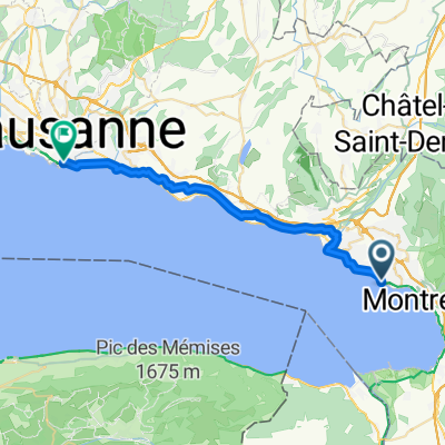 10/11/25 Martigny to Lausanne
- Distance
- 25.9 km
- Ascent
- 384 m
- Descent
- 393 m
- Location
- Le Châtelard, Canton of Vaud, Switzerland
 Clarens-La Guerce
- Distance
- 38.1 km
- Ascent
- 1,023 m
- Descent
- 37 m
- Location
- Le Châtelard, Canton of Vaud, Switzerland
 Chernex-Cerniaule
- Distance
- 9.5 km
- Ascent
- 768 m
- Descent
- 44 m
- Location
- Le Châtelard, Canton of Vaud, Switzerland
 Sentier du Castel-Savoye, Chailly-Montreux to Rathausplatz, برن
- Distance
- 175 km
- Ascent
- 1,965 m
- Descent
- 1,903 m
- Location
- Le Châtelard, Canton of Vaud, Switzerland
 Freiburg - Nizza in 4 Tagen/Tag 2: Montreux - Val d'Isère
- Distance
- 215.3 km
- Ascent
- 4,237 m
- Descent
- 2,784 m
- Location
- Le Châtelard, Canton of Vaud, Switzerland
 trasa NA KOLE OD ŽENEVSKÉHO JEZERA K MATTERHORNU
- Distance
- 117.1 km
- Ascent
- 1,240 m
- Descent
- 1,130 m
- Location
- Le Châtelard, Canton of Vaud, Switzerland
 Clarens Sonchaux Caux
- Distance
- 29.7 km
- Ascent
- 896 m
- Descent
- 896 m
- Location
- Le Châtelard, Canton of Vaud, Switzerland
Open it in the app