- 133.4 km
- 153 m
- 155 m
- Sète, Occitanie, France
Canal du Midì- Véloccitanie corta
A cycling route starting in Sète, Occitanie, France.
Overview
About this route
- 11/9 Sète - Béziers km 55, elevation gain +150 m; 2) 12/9 Béziers - Tourouzelle km 66, elevation gain +250 m; 3) 13/9 Tourouzelle - Bram km 84, elevation gain +300 m; 4) 14/9 Bram - Revel km 65, elevation gain +250 m; 5) 15/9 Revel - Mazamet km 49, elevation gain +500 m; 6) 16/9 Mazamet - Poujol-sur-Orb km 70, elevation gain +300 m; 7) 17/9 Poujol-sur-Orb - Béziers km 54, elevation gain +550 m; 8) 18/9 Béziers - Sète km 56, elevation gain +100 m; Total km 499, elevation gain +2400 m.
- 30 h 35 min
- Duration
- 446 km
- Distance
- 3,075 m
- Ascent
- 3,070 m
- Descent
- 14.6 km/h
- Avg. speed
- 452 m
- Max. altitude
Giancarlo Ortobelli Lozza
created this 6 months ago
Route quality
Waytypes & surfaces along the route
Waytypes
Path
107 km
(24 %)
Cycleway
102.6 km
(23 %)
Surfaces
Paved
147.2 km
(33 %)
Unpaved
196.2 km
(44 %)
Asphalt
147.2 km
(33 %)
Gravel
133.8 km
(30 %)
Route highlights
Points of interest along the route
Accommodation after 109.6 km
Maison de Coquelicot
Accommodation after 174.7 km
Logis Hotel Le Clos Saint Poup
Accommodation after 234.1 km
Logis Hotel - Hotel Restaurant du Midi
Accommodation after 281.4 km
La Grande Maison de Mazamet
Point of interest after 309.9 km
1° GPM m. 433
Accommodation after 349.1 km
Maison Bersane
Point of interest after 364.6 km
2° GPM m. 385
Accommodation after 394.1 km
Zenitude Hotel Residence
Continue with Bikemap
Use, edit, or download this cycling route
You would like to ride Canal du Midì- Véloccitanie corta or customize it for your own trip? Here is what you can do with this Bikemap route:
Free features
- Save this route as favorite or in collections
- Copy & plan your own version of this route
- Split it into stages to create a multi-day tour
- Sync your route with Garmin or Wahoo
Premium features
Free trial for 3 days, or one-time payment. More about Bikemap Premium.
- Navigate this route on iOS & Android
- Export a GPX / KML file of this route
- Create your custom printout (try it for free)
- Download this route for offline navigation
Discover more Premium features.
Get Bikemap PremiumFrom our community
Other popular routes starting in Sète
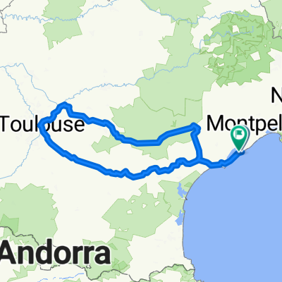
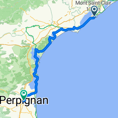
- Sète - Saint-Martin-de-Crau
- La taillade, retour par villeveyrac
- 76.7 km
- 793 m
- 792 m
- Sète, Occitanie, France
- droga z Sete do Le Barcarès
- 126.9 km
- 263 m
- 272 m
- Sète, Occitanie, France
- Sète - Mollégès
- 148.5 km
- 250 m
- 178 m
- Sète, Occitanie, France
- Boulevard Danielle Casanova, Sete nach Béziers
- 51.6 km
- 136 m
- 130 m
- Sète, Occitanie, France
- Sete to Port-Lauragais
- 191.9 km
- 350 m
- 172 m
- Sète, Occitanie, France
- Canal du Midì- Véloccitanie
- 538.7 km
- 3,488 m
- 3,495 m
- Sète, Occitanie, France
- Von Sète bis Perpignan
- 155.6 km
- 371 m
- 345 m
- Sète, Occitanie, France
Open it in the app


