

Ćiro trail Mostar - Dubrovnik
A cycling route starting in Rodoč, Federation of Bosnia and Herzegovina, Bosnia and Herzegovina.
Overview
About this route
- -:--
- Duration
- 142.6 km
- Distance
- 896 m
- Ascent
- 955 m
- Descent
- ---
- Avg. speed
- 355 m
- Max. altitude

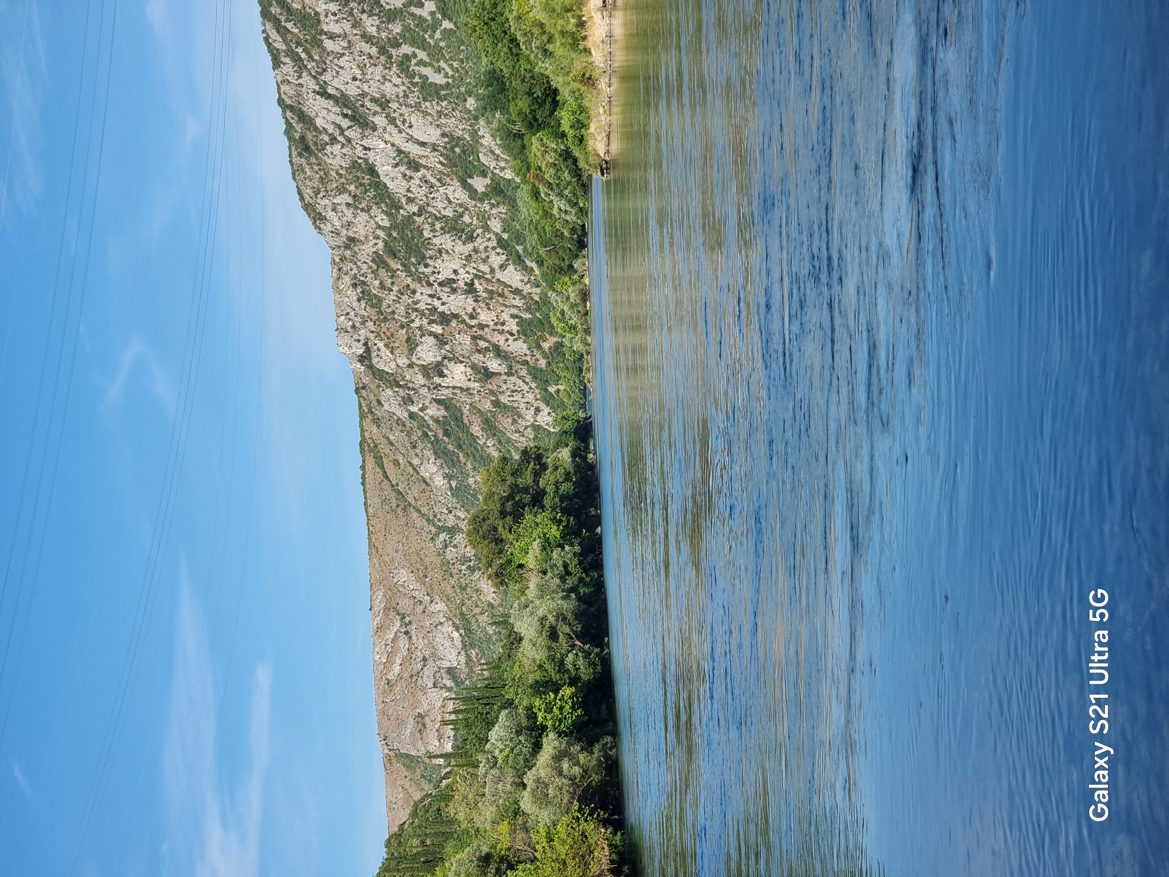
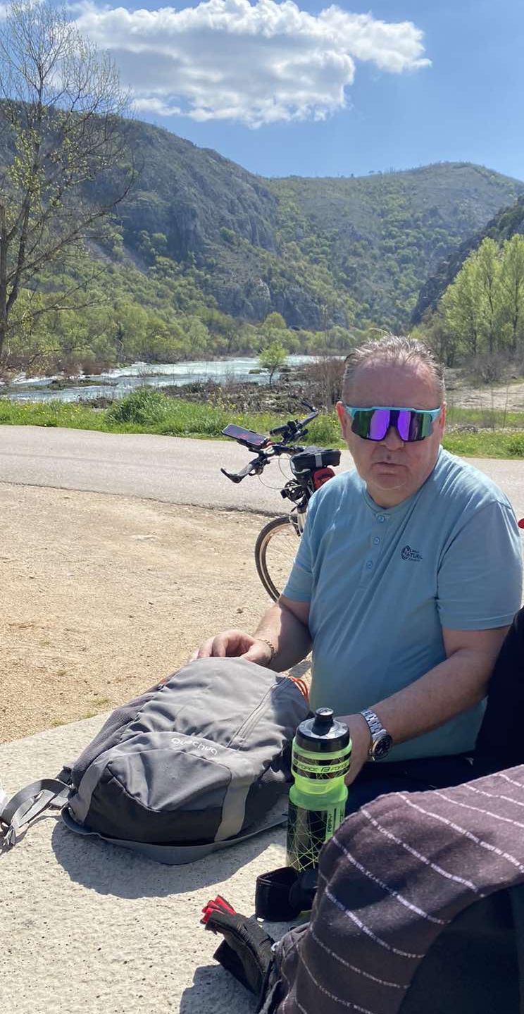
Route photos


Continue with Bikemap
Use, edit, or download this cycling route
You would like to ride Ćiro trail Mostar - Dubrovnik or customize it for your own trip? Here is what you can do with this Bikemap route:
Free features
- Save this route as favorite or in collections
- Copy & plan your own version of this route
- Split it into stages to create a multi-day tour
- Sync your route with Garmin or Wahoo
Premium features
Free trial for 3 days, or one-time payment. More about Bikemap Premium.
- Navigate this route on iOS & Android
- Export a GPX / KML file of this route
- Create your custom printout (try it for free)
- Download this route for offline navigation
Discover more Premium features.
Get Bikemap PremiumFrom our community
Other popular routes starting in Rodoč
 Bišće Polje, Mostar - Bunski kanal - Tekija blagaj - Bisce polje, Mostar
- Distance
- 28.1 km
- Ascent
- 334 m
- Descent
- 334 m
- Location
- Rodoč, Federation of Bosnia and Herzegovina, Bosnia and Herzegovina
 Bunski kanali-Ćirina pruga
- Distance
- 38.6 km
- Ascent
- 101 m
- Descent
- 153 m
- Location
- Rodoč, Federation of Bosnia and Herzegovina, Bosnia and Herzegovina
 Bałkany 2011 - Dzień 9
- Distance
- 86.4 km
- Ascent
- 794 m
- Descent
- 814 m
- Location
- Rodoč, Federation of Bosnia and Herzegovina, Bosnia and Herzegovina
 Čule.........
- Distance
- 11.5 km
- Ascent
- 63 m
- Descent
- 106 m
- Location
- Rodoč, Federation of Bosnia and Herzegovina, Bosnia and Herzegovina
 Rodoc-Goranci-Mostar-Rodoc
- Distance
- 50.1 km
- Ascent
- 936 m
- Descent
- 939 m
- Location
- Rodoč, Federation of Bosnia and Herzegovina, Bosnia and Herzegovina
 Proba1
- Distance
- 249.6 km
- Ascent
- 2,072 m
- Descent
- 2,023 m
- Location
- Rodoč, Federation of Bosnia and Herzegovina, Bosnia and Herzegovina
 Gnojnice - Nevesinje
- Distance
- 40.8 km
- Ascent
- 1,088 m
- Descent
- 272 m
- Location
- Rodoč, Federation of Bosnia and Herzegovina, Bosnia and Herzegovina
 Ćirinom prugom do Čapljine
- Distance
- 64.2 km
- Ascent
- 149 m
- Descent
- 182 m
- Location
- Rodoč, Federation of Bosnia and Herzegovina, Bosnia and Herzegovina
Open it in the app