

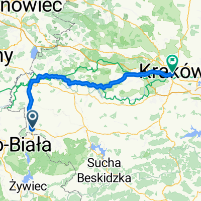
De Jana III Sobieskiego a Jana III Sobieskiego
A cycling route starting in Kęty, Lesser Poland Voivodeship, Poland.
Overview
About this route
- 6 h 18 min
- Duration
- 68.4 km
- Distance
- 527 m
- Ascent
- 571 m
- Descent
- 10.8 km/h
- Avg. speed
- 423 m
- Max. altitude
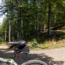
Route photos


Route quality
Waytypes & surfaces along the route
Waytypes
Road
13.7 km
(20 %)
Path
8.2 km
(12 %)
Surfaces
Paved
47.9 km
(70 %)
Unpaved
7.5 km
(11 %)
Asphalt
46.5 km
(68 %)
Ground
4.8 km
(7 %)
Continue with Bikemap
Use, edit, or download this cycling route
You would like to ride De Jana III Sobieskiego a Jana III Sobieskiego or customize it for your own trip? Here is what you can do with this Bikemap route:
Free features
- Save this route as favorite or in collections
- Copy & plan your own version of this route
- Sync your route with Garmin or Wahoo
Premium features
Free trial for 3 days, or one-time payment. More about Bikemap Premium.
- Navigate this route on iOS & Android
- Export a GPX / KML file of this route
- Create your custom printout (try it for free)
- Download this route for offline navigation
Discover more Premium features.
Get Bikemap PremiumFrom our community
Other popular routes starting in Kęty
 Przegibek, Tresna, Porąbka
- Distance
- 50.1 km
- Ascent
- 654 m
- Descent
- 665 m
- Location
- Kęty, Lesser Poland Voivodeship, Poland
 hhhjjjjjjj
- Distance
- 50.2 km
- Ascent
- 605 m
- Descent
- 616 m
- Location
- Kęty, Lesser Poland Voivodeship, Poland
 Kety Osvet Krakow
- Distance
- 81.7 km
- Ascent
- 162 m
- Descent
- 218 m
- Location
- Kęty, Lesser Poland Voivodeship, Poland
 2018/13 Żar do Porąbki
- Distance
- 49.7 km
- Ascent
- 861 m
- Descent
- 862 m
- Location
- Kęty, Lesser Poland Voivodeship, Poland
 Do zapory
- Distance
- 23.2 km
- Ascent
- 102 m
- Descent
- 103 m
- Location
- Kęty, Lesser Poland Voivodeship, Poland
 Kęty - Babia Góra
- Distance
- 125.8 km
- Ascent
- 1,308 m
- Descent
- 1,254 m
- Location
- Kęty, Lesser Poland Voivodeship, Poland
 Starą Drogą do Czańca
- Distance
- 24.8 km
- Ascent
- 145 m
- Descent
- 145 m
- Location
- Kęty, Lesser Poland Voivodeship, Poland
- De Jana III Sobieskiego a Jana III Sobieskiego
- Distance
- 68.4 km
- Ascent
- 527 m
- Descent
- 571 m
- Location
- Kęty, Lesser Poland Voivodeship, Poland
Open it in the app