
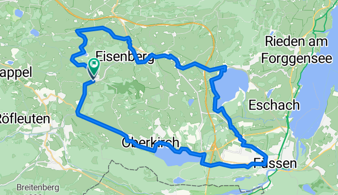
Allgäu-Schlösser und Ruinen kurz ab Zell
A cycling route starting in Eisenberg, Bavaria, Germany.
Overview
About this route
- 2 h 14 min
- Duration
- 32.6 km
- Distance
- 450 m
- Ascent
- 449 m
- Descent
- 14.6 km/h
- Avg. speed
- 952 m
- Max. altitude
Continue with Bikemap
Use, edit, or download this cycling route
You would like to ride Allgäu-Schlösser und Ruinen kurz ab Zell or customize it for your own trip? Here is what you can do with this Bikemap route:
Free features
- Save this route as favorite or in collections
- Copy & plan your own version of this route
- Sync your route with Garmin or Wahoo
Premium features
Free trial for 3 days, or one-time payment. More about Bikemap Premium.
- Navigate this route on iOS & Android
- Export a GPX / KML file of this route
- Create your custom printout (try it for free)
- Download this route for offline navigation
Discover more Premium features.
Get Bikemap PremiumFrom our community
Other popular routes starting in Eisenberg
 Falkenstein
- Distance
- 7.3 km
- Ascent
- 482 m
- Descent
- 482 m
- Location
- Eisenberg, Bavaria, Germany
 Runde vom Weißensee
- Distance
- 31 km
- Ascent
- 278 m
- Descent
- 277 m
- Location
- Eisenberg, Bavaria, Germany
 Wiedmarer Straße, Füssen to Füssen, Füssen
- Distance
- 9.1 km
- Ascent
- 70 m
- Descent
- 137 m
- Location
- Eisenberg, Bavaria, Germany
 Peters kleine Runde
- Distance
- 4.3 km
- Ascent
- 51 m
- Descent
- 50 m
- Location
- Eisenberg, Bavaria, Germany
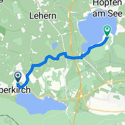 Hopfensee
- Distance
- 6.1 km
- Ascent
- 82 m
- Descent
- 95 m
- Location
- Eisenberg, Bavaria, Germany
 2013-13 Altmühltal - Ammersee - Allgäu Eisenberg - Eckarts
- Distance
- 47.2 km
- Ascent
- 416 m
- Descent
- 529 m
- Location
- Eisenberg, Bavaria, Germany
 August18_Ver2.1
- Distance
- 264.9 km
- Ascent
- 2,195 m
- Descent
- 2,427 m
- Location
- Eisenberg, Bavaria, Germany
 20120517 Allgaeu
- Distance
- 58.4 km
- Ascent
- 1,017 m
- Descent
- 1,017 m
- Location
- Eisenberg, Bavaria, Germany
Open it in the app