
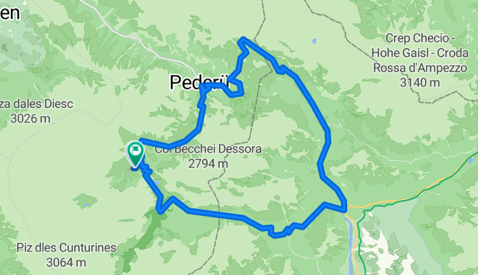
la varela giro
A cycling route starting in San Genesio, Trentino-Alto Adige, Italy.
Overview
About this route
- 3 h 59 min
- Duration
- 33.3 km
- Distance
- 1,918 m
- Ascent
- 1,927 m
- Descent
- 8.4 km/h
- Avg. speed
- 2,174 m
- Max. altitude

Route quality
Waytypes & surfaces along the route
Waytypes
Track
28 km
(84 %)
Access road
3 km
(9 %)
Surfaces
Paved
5 km
(15 %)
Unpaved
27.6 km
(83 %)
Gravel
26 km
(78 %)
Asphalt
4 km
(12 %)
Continue with Bikemap
Use, edit, or download this cycling route
You would like to ride la varela giro or customize it for your own trip? Here is what you can do with this Bikemap route:
Free features
- Save this route as favorite or in collections
- Copy & plan your own version of this route
- Sync your route with Garmin or Wahoo
Premium features
Free trial for 3 days, or one-time payment. More about Bikemap Premium.
- Navigate this route on iOS & Android
- Export a GPX / KML file of this route
- Create your custom printout (try it for free)
- Download this route for offline navigation
Discover more Premium features.
Get Bikemap PremiumFrom our community
Other popular routes starting in San Genesio
 Fanes-Sennes-Runde
- Distance
- 31.2 km
- Ascent
- 1,524 m
- Descent
- 1,523 m
- Location
- San Genesio, Trentino-Alto Adige, Italy
 Fanes-Senes Runde
- Distance
- 45.3 km
- Ascent
- 2,428 m
- Descent
- 2,196 m
- Location
- San Genesio, Trentino-Alto Adige, Italy
 Transalp 2017 #7
- Distance
- 31 km
- Ascent
- 1,044 m
- Descent
- 1,358 m
- Location
- San Genesio, Trentino-Alto Adige, Italy
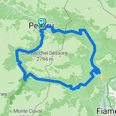 Pederù - Fodara Vedla - Ra Stüa - Malga Fanes - Pederù
- Distance
- 30.5 km
- Ascent
- 1,445 m
- Descent
- 1,444 m
- Location
- San Genesio, Trentino-Alto Adige, Italy
 gunter 5
- Distance
- 41.2 km
- Ascent
- 1,861 m
- Descent
- 1,881 m
- Location
- San Genesio, Trentino-Alto Adige, Italy
 Pederu-riscone ritorno
- Distance
- 31.3 km
- Ascent
- 419 m
- Descent
- 1,037 m
- Location
- San Genesio, Trentino-Alto Adige, Italy
 Oesterreich - Dolomiti 5/7
- Distance
- 125.1 km
- Ascent
- 3,789 m
- Descent
- 3,758 m
- Location
- San Genesio, Trentino-Alto Adige, Italy
 La Val - Wengen - La Valle - Taéla - Dlijia da la Crusc - Heiligkreuz-Hospitz
- Distance
- 30.6 km
- Ascent
- 1,135 m
- Descent
- 1,137 m
- Location
- San Genesio, Trentino-Alto Adige, Italy
Open it in the app