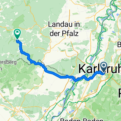
Wolfartsweier-Stupferich-Kleinsteinbach-Runde
A cycling route starting in Karlsruhe, Baden-Wurttemberg, Germany.
Overview
About this route
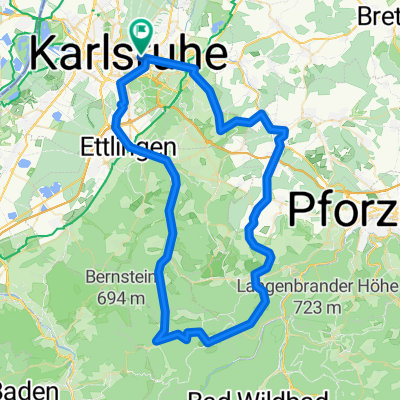
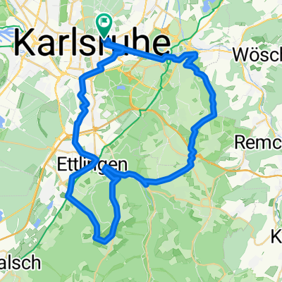
Quick evening ride after work. First a bit uphill and then just downhill. It's fun. And the chicken thief at the old Kleinsteinbach station is quite nice in summer.
- -:--
- Duration
- 24.6 km
- Distance
- 190 m
- Ascent
- 196 m
- Descent
- ---
- Avg. speed
- 272 m
- Max. altitude
Route quality
Waytypes & surfaces along the route
Waytypes
Quiet road
8.4 km
(34 %)
Track
4.9 km
(20 %)
Surfaces
Paved
23.2 km
(94 %)
Unpaved
0.2 km
(1 %)
Asphalt
20.7 km
(84 %)
Paved (undefined)
2.5 km
(10 %)
Continue with Bikemap
Use, edit, or download this cycling route
You would like to ride Wolfartsweier-Stupferich-Kleinsteinbach-Runde or customize it for your own trip? Here is what you can do with this Bikemap route:
Free features
- Save this route as favorite or in collections
- Copy & plan your own version of this route
- Sync your route with Garmin or Wahoo
Premium features
Free trial for 3 days, or one-time payment. More about Bikemap Premium.
- Navigate this route on iOS & Android
- Export a GPX / KML file of this route
- Create your custom printout (try it for free)
- Download this route for offline navigation
Discover more Premium features.
Get Bikemap PremiumFrom our community
Other popular routes starting in Karlsruhe
Wolfartsweier-Stupferich-Kleinsteinbach-Runde- Distance
- 24.6 km
- Ascent
- 190 m
- Descent
- 196 m
- Location
- Karlsruhe, Baden-Wurttemberg, Germany
Karlsruhe-Würzburg- Distance
- 1,073.9 km
- Ascent
- 12,936 m
- Descent
- 12,878 m
- Location
- Karlsruhe, Baden-Wurttemberg, Germany
leopoldshafen Baggersee- Distance
- 13.3 km
- Ascent
- 0 m
- Descent
- 10 m
- Location
- Karlsruhe, Baden-Wurttemberg, Germany
Von KA-Beiertheim nach Würmersheim (Durmersheim)- Distance
- 16.1 km
- Ascent
- 18 m
- Descent
- 83 m
- Location
- Karlsruhe, Baden-Wurttemberg, Germany
50KM Turmberg Tour- Distance
- 47.8 km
- Ascent
- 450 m
- Descent
- 450 m
- Location
- Karlsruhe, Baden-Wurttemberg, Germany
Rheinfähre- Distance
- 38.8 km
- Ascent
- 48 m
- Descent
- 44 m
- Location
- Karlsruhe, Baden-Wurttemberg, Germany
Turmberg Funkturm Bismarckturm- Distance
- 33.8 km
- Ascent
- 533 m
- Descent
- 536 m
- Location
- Karlsruhe, Baden-Wurttemberg, Germany
Durlach Bad Herrenalb Dobel Remchingen- Distance
- 72.3 km
- Ascent
- 894 m
- Descent
- 893 m
- Location
- Karlsruhe, Baden-Wurttemberg, Germany
Open it in the app

