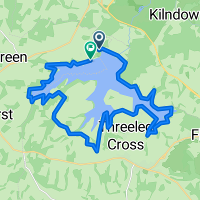
Groombridge forest loop minus kidds + tidebrook hill
A cycling route starting in Wadhurst, England, United Kingdom.
Overview
About this route
Chucjk hatch, plus rotherfield hills and tidebrook upto best beech.
- -:--
- Duration
- 48.7 km
- Distance
- 532 m
- Ascent
- 532 m
- Descent
- ---
- Avg. speed
- ---
- Max. altitude
Route quality
Waytypes & surfaces along the route
Waytypes
Road
20.4 km
(42 %)
Cycleway
1.9 km
(4 %)
Surfaces
Paved
23.8 km
(49 %)
Asphalt
23.8 km
(49 %)
Undefined
24.8 km
(51 %)
Continue with Bikemap
Use, edit, or download this cycling route
You would like to ride Groombridge forest loop minus kidds + tidebrook hill or customize it for your own trip? Here is what you can do with this Bikemap route:
Free features
- Save this route as favorite or in collections
- Copy & plan your own version of this route
- Sync your route with Garmin or Wahoo
Premium features
Free trial for 3 days, or one-time payment. More about Bikemap Premium.
- Navigate this route on iOS & Android
- Export a GPX / KML file of this route
- Create your custom printout (try it for free)
- Download this route for offline navigation
Discover more Premium features.
Get Bikemap PremiumFrom our community
Other popular routes starting in Wadhurst
- 18km circle
- Distance
- 17.6 km
- Ascent
- 293 m
- Descent
- 293 m
- Location
- Wadhurst, England, United Kingdom
- bewl water
- Distance
- 25.4 km
- Ascent
- 344 m
- Descent
- 302 m
- Location
- Wadhurst, England, United Kingdom
- April 18
- Distance
- 92.5 km
- Ascent
- 634 m
- Descent
- 650 m
- Location
- Wadhurst, England, United Kingdom
- Groombridge, chuck hatch kidds hill rotherfield
- Distance
- 61.4 km
- Ascent
- 626 m
- Descent
- 626 m
- Location
- Wadhurst, England, United Kingdom
- jill / ade /helen 2
- Distance
- 24.9 km
- Ascent
- 325 m
- Descent
- 324 m
- Location
- Wadhurst, England, United Kingdom
- Groombridge forest loop minus kidds + tidebrook hill
- Distance
- 48.7 km
- Ascent
- 532 m
- Descent
- 532 m
- Location
- Wadhurst, England, United Kingdom
- paddock wood
- Distance
- 17.2 km
- Ascent
- 219 m
- Descent
- 342 m
- Location
- Wadhurst, England, United Kingdom
- Wadhurst - Ashdown Forest
- Distance
- 56.5 km
- Ascent
- 676 m
- Descent
- 676 m
- Location
- Wadhurst, England, United Kingdom
Open it in the app