
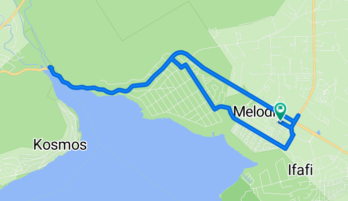
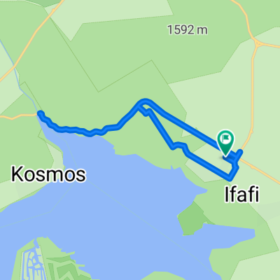
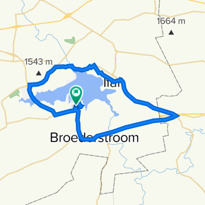
Harties Oefening
A cycling route starting in Brits, North West, Republic of South Africa.
Overview
About this route
- 45 min
- Duration
- 13.2 km
- Distance
- 153 m
- Ascent
- 153 m
- Descent
- 17.5 km/h
- Avg. speed
- 1,230 m
- Max. altitude

Route quality
Waytypes & surfaces along the route
Waytypes
Quiet road
4.2 km
(32 %)
Access road
0.4 km
(3 %)
Undefined
8.6 km
(65 %)
Surfaces
Paved
10.6 km
(80 %)
Asphalt
10.5 km
(79 %)
Paved (undefined)
0.1 km
(1 %)
Undefined
2.6 km
(20 %)
Continue with Bikemap
Use, edit, or download this cycling route
You would like to ride Harties Oefening or customize it for your own trip? Here is what you can do with this Bikemap route:
Free features
- Save this route as favorite or in collections
- Copy & plan your own version of this route
- Sync your route with Garmin or Wahoo
Premium features
Free trial for 3 days, or one-time payment. More about Bikemap Premium.
- Navigate this route on iOS & Android
- Export a GPX / KML file of this route
- Create your custom printout (try it for free)
- Download this route for offline navigation
Discover more Premium features.
Get Bikemap PremiumFrom our community
Other popular routes starting in Brits
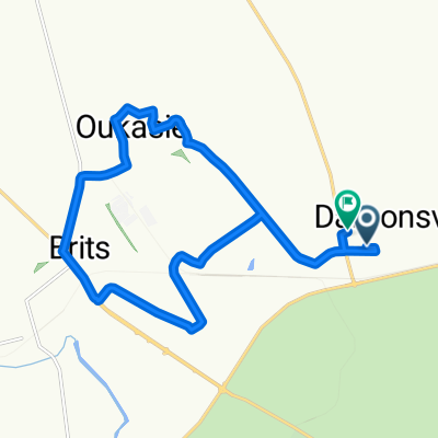
 Hartebeespoorht to Damonsville
- Distance
- 19.3 km
- Ascent
- 138 m
- Descent
- 174 m
- Location
- Brits, North West, Republic of South Africa
 Route from Magalies Blvd, Hartbeespoort
- Distance
- 6.2 km
- Ascent
- 16 m
- Descent
- 4 m
- Location
- Brits, North West, Republic of South Africa
 Rust Oord 83Km
- Distance
- 82.9 km
- Ascent
- 390 m
- Descent
- 390 m
- Location
- Brits, North West, Republic of South Africa
 Route from Krokkodildrif Lane
- Distance
- 40.2 km
- Ascent
- 231 m
- Descent
- 247 m
- Location
- Brits, North West, Republic of South Africa
 Harties Oefening
- Distance
- 13.2 km
- Ascent
- 153 m
- Descent
- 153 m
- Location
- Brits, North West, Republic of South Africa
 BSG Harties
- Distance
- 25.3 km
- Ascent
- 155 m
- Descent
- 156 m
- Location
- Brits, North West, Republic of South Africa
 Hartbeespoort Dam
- Distance
- 47.7 km
- Ascent
- 561 m
- Descent
- 559 m
- Location
- Brits, North West, Republic of South Africa
 Moderate route
- Distance
- 21.3 km
- Ascent
- 141 m
- Descent
- 167 m
- Location
- Brits, North West, Republic of South Africa
Open it in the app