

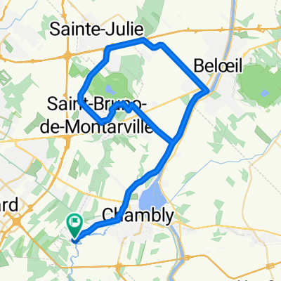
Chambly - Mt-St-Grégoire
A cycling route starting in Carignan, Quebec, Canada.
Overview
About this route
Roads in very good condition except for the section between Chemin de la Savane and Rang des 54. Not much traffic and respectful drivers. Only obstacle: small climb when approaching Chemin du Sous-bois in Mont-Saint-Grégoire. But it is very doable...
- -:--
- Duration
- 39.1 km
- Distance
- 80 m
- Ascent
- 60 m
- Descent
- ---
- Avg. speed
- ---
- Max. altitude
Route quality
Waytypes & surfaces along the route
Waytypes
Road
35.6 km
(91 %)
Quiet road
0.8 km
(2 %)
Surfaces
Paved
32.5 km
(83 %)
Asphalt
32.5 km
(83 %)
Undefined
6.7 km
(17 %)
Continue with Bikemap
Use, edit, or download this cycling route
You would like to ride Chambly - Mt-St-Grégoire or customize it for your own trip? Here is what you can do with this Bikemap route:
Free features
- Save this route as favorite or in collections
- Copy & plan your own version of this route
- Sync your route with Garmin or Wahoo
Premium features
Free trial for 3 days, or one-time payment. More about Bikemap Premium.
- Navigate this route on iOS & Android
- Export a GPX / KML file of this route
- Create your custom printout (try it for free)
- Download this route for offline navigation
Discover more Premium features.
Get Bikemap PremiumFrom our community
Other popular routes starting in Carignan
 chambly canal
- Distance
- 6.9 km
- Ascent
- 8 m
- Descent
- 8 m
- Location
- Carignan, Quebec, Canada
 OACycle
- Distance
- 59.7 km
- Ascent
- 99 m
- Descent
- 100 m
- Location
- Carignan, Quebec, Canada
 The long one Rive-Sud
- Distance
- 72 km
- Ascent
- 184 m
- Descent
- 184 m
- Location
- Carignan, Quebec, Canada
 Chambly - Mt-St-Grégoire
- Distance
- 39.1 km
- Ascent
- 80 m
- Descent
- 60 m
- Location
- Carignan, Quebec, Canada
 De Chambly à Mont-Saint-Grégoire ( boucle )
- Distance
- 71.5 km
- Ascent
- 172 m
- Descent
- 173 m
- Location
- Carignan, Quebec, Canada
 Spred Out Sunday Route In Chambly
- Distance
- 39.1 km
- Ascent
- 41 m
- Descent
- 46 m
- Location
- Carignan, Quebec, Canada
 Chambly-Mont St-Grégoire
- Distance
- 50.9 km
- Ascent
- 51 m
- Descent
- 54 m
- Location
- Carignan, Quebec, Canada
 Chambly-Beloeil
- Distance
- 46.6 km
- Ascent
- 123 m
- Descent
- 119 m
- Location
- Carignan, Quebec, Canada
Open it in the app