

11.03.06.Basel-,Solo-,Argaubiet Runde CLONED FROM ROUTE 844909
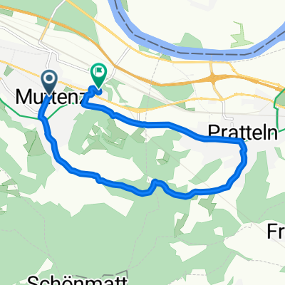
A cycling route starting in Muttenz, Basel-Landschaft, Switzerland.
Overview
About this route
Durch sehr schöne Landschaft, immer etwas hoch und runter--
Leider etwas frisch mit fuck wind
112km, 5h30 netto, 2350hm (laut HAC+ Garmin)
- -:--
- Duration
- 110.2 km
- Distance
- 1,849 m
- Ascent
- 1,870 m
- Descent
- ---
- Avg. speed
- ---
- Max. altitude
Route quality
Waytypes & surfaces along the route
Waytypes
Road
55.1 km
(50 %)
Quiet road
14.3 km
(13 %)
Surfaces
Paved
90.4 km
(82 %)
Unpaved
4.4 km
(4 %)
Asphalt
88.2 km
(80 %)
Gravel
3.3 km
(3 %)
Continue with Bikemap
Use, edit, or download this cycling route
You would like to ride 11.03.06.Basel-,Solo-,Argaubiet Runde CLONED FROM ROUTE 844909 or customize it for your own trip? Here is what you can do with this Bikemap route:
Free features
- Save this route as favorite or in collections
- Copy & plan your own version of this route
- Split it into stages to create a multi-day tour
- Sync your route with Garmin or Wahoo
Premium features
Free trial for 3 days, or one-time payment. More about Bikemap Premium.
- Navigate this route on iOS & Android
- Export a GPX / KML file of this route
- Create your custom printout (try it for free)
- Download this route for offline navigation
Discover more Premium features.
Get Bikemap PremiumFrom our community
Other popular routes starting in Muttenz
 Entspannende Route in Rheinfelden
- Distance
- 14.7 km
- Ascent
- 192 m
- Descent
- 214 m
- Location
- Muttenz, Basel-Landschaft, Switzerland
 Muttenz, Buus, Mumpf, Augst
- Distance
- 70.5 km
- Ascent
- 862 m
- Descent
- 864 m
- Location
- Muttenz, Basel-Landschaft, Switzerland
 Lange Ausfahrt durch Muttenz
- Distance
- 35 km
- Ascent
- 217 m
- Descent
- 217 m
- Location
- Muttenz, Basel-Landschaft, Switzerland
 Gempen Panorama Tour
- Distance
- 25.1 km
- Ascent
- 803 m
- Descent
- 801 m
- Location
- Muttenz, Basel-Landschaft, Switzerland
 Hills then flat
- Distance
- 133.5 km
- Ascent
- 3,898 m
- Descent
- 3,841 m
- Location
- Muttenz, Basel-Landschaft, Switzerland
 11.03.06.Basel-,Solo-,Argaubiet Runde CLONED FROM ROUTE 844909
- Distance
- 110.2 km
- Ascent
- 1,849 m
- Descent
- 1,870 m
- Location
- Muttenz, Basel-Landschaft, Switzerland
 Muttenz
- Distance
- 9.6 km
- Ascent
- 193 m
- Descent
- 196 m
- Location
- Muttenz, Basel-Landschaft, Switzerland
 Muttenz - Stollenhäuser
- Distance
- 15.3 km
- Ascent
- 500 m
- Descent
- 500 m
- Location
- Muttenz, Basel-Landschaft, Switzerland
Open it in the app