
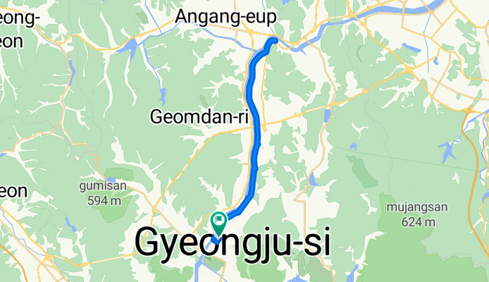
20250617
A cycling route starting in Gyeongju, Gyeongsangbuk-do, South Korea.
Overview
About this route
- 2 h 4 min
- Duration
- 30 km
- Distance
- 43 m
- Ascent
- 86 m
- Descent
- 14.5 km/h
- Avg. speed
- 68 m
- Max. altitude
Continue with Bikemap
Use, edit, or download this cycling route
You would like to ride 20250617 or customize it for your own trip? Here is what you can do with this Bikemap route:
Free features
- Save this route as favorite or in collections
- Copy & plan your own version of this route
- Sync your route with Garmin or Wahoo
Premium features
Free trial for 3 days, or one-time payment. More about Bikemap Premium.
- Navigate this route on iOS & Android
- Export a GPX / KML file of this route
- Create your custom printout (try it for free)
- Download this route for offline navigation
Discover more Premium features.
Get Bikemap PremiumFrom our community
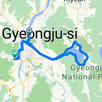
Other popular routes starting in Gyeongju
 경주(낭산의 신비를 찾아서)
- Distance
- 14.4 km
- Ascent
- 128 m
- Descent
- 111 m
- Location
- Gyeongju, Gyeongsangbuk-do, South Korea
 천군동 168-6, 경주시 ~ 천군동 206-13, 경주시
- Distance
- 27.8 km
- Ascent
- 149 m
- Descent
- 147 m
- Location
- Gyeongju, Gyeongsangbuk-do, South Korea
![Ph0]에서 경로충효동 117-4](https://media.bikemap.net/routes/17519728/staticmaps/in_8151b71c-61ef-451f-aa6a-ab795a0b558f_400x400_bikemap-2021-3D-static.png) Ph0]에서 경로충효동 117-4
Ph0]에서 경로충효동 117-4- Distance
- 28.2 km
- Ascent
- 131 m
- Descent
- 161 m
- Location
- Gyeongju, Gyeongsangbuk-do, South Korea
 경주 KTX-24블루원고개-35불국로고개-55기림로고개-75방산로고개-103숙소-120추령-남산
- Distance
- 143.3 km
- Ascent
- 2,422 m
- Descent
- 2,454 m
- Location
- Gyeongju, Gyeongsangbuk-do, South Korea
![Ph0]에서 경로북군동 11-1](https://media.bikemap.net/routes/17321743/gallery/thumbs/16e4758b-722a-401a-b822-211a2e7d452b.jpg.208x208_q80_crop.jpg) Ph0]에서 경로북군동 11-1
Ph0]에서 경로북군동 11-1- Distance
- 729.6 km
- Ascent
- 26,913 m
- Descent
- 26,991 m
- Location
- Gyeongju, Gyeongsangbuk-do, South Korea
 초음속 경로
- Distance
- 34.4 km
- Ascent
- 192 m
- Descent
- 223 m
- Location
- Gyeongju, Gyeongsangbuk-do, South Korea
 성건동, 경주시에서 약성리, 포항시까지
- Distance
- 46.9 km
- Ascent
- 330 m
- Descent
- 369 m
- Location
- Gyeongju, Gyeongsangbuk-do, South Korea
 경주 자전거코스
- Distance
- 32.4 km
- Ascent
- 932 m
- Descent
- 932 m
- Location
- Gyeongju, Gyeongsangbuk-do, South Korea
Open it in the app