

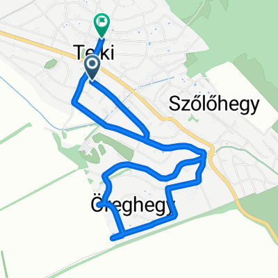
Kossuth Lajos utca - Kossuth Lajos utca
A cycling route starting in Telki, Pest County, Hungary.
Overview
About this route
- 1 h 18 min
- Duration
- 13.7 km
- Distance
- 115 m
- Ascent
- 166 m
- Descent
- 10.5 km/h
- Avg. speed
- 244 m
- Max. altitude
Route quality
Waytypes & surfaces along the route
Waytypes
Track
8.6 km
(63 %)
Quiet road
3.7 km
(27 %)
Surfaces
Paved
3.7 km
(27 %)
Unpaved
9.7 km
(71 %)
Ground
6.8 km
(50 %)
Asphalt
3.6 km
(26 %)
Continue with Bikemap
Use, edit, or download this cycling route
You would like to ride Kossuth Lajos utca - Kossuth Lajos utca or customize it for your own trip? Here is what you can do with this Bikemap route:
Free features
- Save this route as favorite or in collections
- Copy & plan your own version of this route
- Sync your route with Garmin or Wahoo
Premium features
Free trial for 3 days, or one-time payment. More about Bikemap Premium.
- Navigate this route on iOS & Android
- Export a GPX / KML file of this route
- Create your custom printout (try it for free)
- Download this route for offline navigation
Discover more Premium features.
Get Bikemap PremiumFrom our community
Other popular routes starting in Telki
 Janoshegy
- Distance
- 30.6 km
- Ascent
- 791 m
- Descent
- 973 m
- Location
- Telki, Pest County, Hungary
 Kutyával
- Distance
- 12.8 km
- Ascent
- 146 m
- Descent
- 146 m
- Location
- Telki, Pest County, Hungary
 Petőfi Sándor utca - Muskátli utca
- Distance
- 0.9 km
- Ascent
- 0 m
- Descent
- 53 m
- Location
- Telki, Pest County, Hungary
 Gellért hegy János hegy
- Distance
- 62.6 km
- Ascent
- 968 m
- Descent
- 842 m
- Location
- Telki, Pest County, Hungary
 Hűvösvölgy - Svábhegy
- Distance
- 53.8 km
- Ascent
- 872 m
- Descent
- 801 m
- Location
- Telki, Pest County, Hungary
 Májusi körtúra
- Distance
- 76.2 km
- Ascent
- 421 m
- Descent
- 422 m
- Location
- Telki, Pest County, Hungary
 szept.7.
- Distance
- 5.9 km
- Ascent
- 55 m
- Descent
- 101 m
- Location
- Telki, Pest County, Hungary
 telki dunakanyar kör
- Distance
- 147.1 km
- Ascent
- 487 m
- Descent
- 489 m
- Location
- Telki, Pest County, Hungary
Open it in the app