

Wolfsgraben-Irenental-Sieghartskirchen-Rekawinkel-Preßbaum. 🚴♂️🚴
A cycling route starting in Wolfsgraben, Lower Austria, Austria.
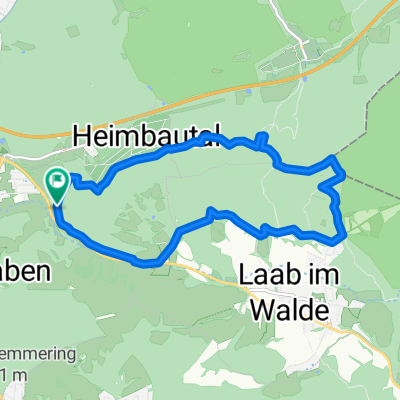
Overview
About this route
- 3 h 41 min
- Duration
- 41.5 km
- Distance
- 448 m
- Ascent
- 443 m
- Descent
- 11.3 km/h
- Avg. speed
- 416 m
- Max. altitude

Route photos


Route quality
Waytypes & surfaces along the route
Waytypes
Road
17 km
(41 %)
Cycleway
3.3 km
(8 %)
Surfaces
Paved
31.5 km
(76 %)
Asphalt
31.5 km
(76 %)
Undefined
10 km
(24 %)
Continue with Bikemap
Use, edit, or download this cycling route
You would like to ride Wolfsgraben-Irenental-Sieghartskirchen-Rekawinkel-Preßbaum. 🚴♂️🚴 or customize it for your own trip? Here is what you can do with this Bikemap route:
Free features
- Save this route as favorite or in collections
- Copy & plan your own version of this route
- Sync your route with Garmin or Wahoo
Premium features
Free trial for 3 days, or one-time payment. More about Bikemap Premium.
- Navigate this route on iOS & Android
- Export a GPX / KML file of this route
- Create your custom printout (try it for free)
- Download this route for offline navigation
Discover more Premium features.
Get Bikemap PremiumFrom our community
Other popular routes starting in Wolfsgraben
 Wolfsgraben-Wienerwaldrunde
- Distance
- 71.3 km
- Ascent
- 1,243 m
- Descent
- 1,189 m
- Location
- Wolfsgraben, Lower Austria, Austria
 2020-05-17 1:52 Georgienberg Strecke
- Distance
- 31.6 km
- Ascent
- 512 m
- Descent
- 532 m
- Location
- Wolfsgraben, Lower Austria, Austria
 Roppersberg-Strecke
- Distance
- 10.5 km
- Ascent
- 327 m
- Descent
- 327 m
- Location
- Wolfsgraben, Lower Austria, Austria
 schöpflrunde
- Distance
- 69 km
- Ascent
- 1,183 m
- Descent
- 1,208 m
- Location
- Wolfsgraben, Lower Austria, Austria
 irenental--gruberau-hochroterd
- Distance
- 64.3 km
- Ascent
- 855 m
- Descent
- 855 m
- Location
- Wolfsgraben, Lower Austria, Austria
 Rund um Wien
- Distance
- 128.7 km
- Ascent
- 405 m
- Descent
- 403 m
- Location
- Wolfsgraben, Lower Austria, Austria
 Troppbergstrecke I 2021-10-02 2:32
- Distance
- 38.7 km
- Ascent
- 442 m
- Descent
- 606 m
- Location
- Wolfsgraben, Lower Austria, Austria
 Wienerwaldsee 83
- Distance
- 83.8 km
- Ascent
- 1,242 m
- Descent
- 1,221 m
- Location
- Wolfsgraben, Lower Austria, Austria
Open it in the app