

Wiesengasse nach Alte Poststraße
A cycling route starting in Spremberg, Brandenburg, Germany.
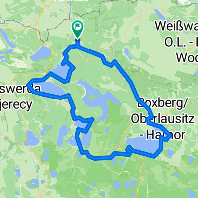
Overview
About this route
- 1 h 12 min
- Duration
- 12.2 km
- Distance
- 71 m
- Ascent
- 136 m
- Descent
- 10.2 km/h
- Avg. speed
- 177 m
- Max. altitude

Route photos


Route quality
Waytypes & surfaces along the route
Waytypes
Path
4.9 km
(40 %)
Quiet road
2.8 km
(23 %)
Surfaces
Paved
10.4 km
(85 %)
Unpaved
0.4 km
(3 %)
Asphalt
8.3 km
(68 %)
Paved (undefined)
2.1 km
(17 %)
Continue with Bikemap
Use, edit, or download this cycling route
You would like to ride Wiesengasse nach Alte Poststraße or customize it for your own trip? Here is what you can do with this Bikemap route:
Free features
- Save this route as favorite or in collections
- Copy & plan your own version of this route
- Sync your route with Garmin or Wahoo
Premium features
Free trial for 3 days, or one-time payment. More about Bikemap Premium.
- Navigate this route on iOS & Android
- Export a GPX / KML file of this route
- Create your custom printout (try it for free)
- Download this route for offline navigation
Discover more Premium features.
Get Bikemap PremiumFrom our community
Other popular routes starting in Spremberg
 Spreeradweg ab Spremberg
- Distance
- 296 km
- Ascent
- 999 m
- Descent
- 1,091 m
- Location
- Spremberg, Brandenburg, Germany
 Von Spremberg bis Elsterheide
- Distance
- 45.3 km
- Ascent
- 110 m
- Descent
- 116 m
- Location
- Spremberg, Brandenburg, Germany
 Bärwalder See
- Distance
- 75.6 km
- Ascent
- 101 m
- Descent
- 102 m
- Location
- Spremberg, Brandenburg, Germany
 Senftenberger Straße 15, Spremberg nach Senftenberger Straße 13, Spremberg
- Distance
- 48 km
- Ascent
- 195 m
- Descent
- 202 m
- Location
- Spremberg, Brandenburg, Germany
 Rund um Spremberg
- Distance
- 32.9 km
- Ascent
- 184 m
- Descent
- 178 m
- Location
- Spremberg, Brandenburg, Germany
 Spreeradweg
- Distance
- 250.8 km
- Ascent
- 90 m
- Descent
- 163 m
- Location
- Spremberg, Brandenburg, Germany
 Route in Spreetal
- Distance
- 80.5 km
- Ascent
- 303 m
- Descent
- 303 m
- Location
- Spremberg, Brandenburg, Germany
 Waldweg 23, Spremberg nach Waldweg 23, Spremberg
- Distance
- 46.5 km
- Ascent
- 160 m
- Descent
- 200 m
- Location
- Spremberg, Brandenburg, Germany
Open it in the app