

Green Belt - Stage 8
A cycling route starting in Henneberg, Thuringia, Germany.
Overview
About this route
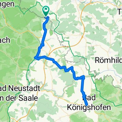
Ungefähr entlang der früheren Grenze DDR/BRD von Schwickershausen zum Berghotel Eisenach auf dem Ellenbogen, dem höchsten thüringischen Rhön-Berg. Unterwegs die stimmungsvolle Wüstung Schmerbach, Fladungen mit Fachwerk und Freilichtmuseum, und ein eindrucksvolles Hochmoor (Schwarzes Moor). Und die Hochrhön.
Der Abstecher nach Bettenhausen dient lediglich der Erzielung von zusätzlichen Höhenmetern.
- -:--
- Duration
- 61.4 km
- Distance
- 1,016 m
- Ascent
- 587 m
- Descent
- ---
- Avg. speed
- ---
- Max. altitude

Route quality
Waytypes & surfaces along the route
Waytypes
Busy road
21.6 km
(35 %)
Track
17.9 km
(29 %)
Surfaces
Paved
32.7 km
(53 %)
Unpaved
6.1 km
(10 %)
Asphalt
30 km
(49 %)
Paved (undefined)
2.6 km
(4 %)
Continue with Bikemap
Use, edit, or download this cycling route
You would like to ride Green Belt - Stage 8 or customize it for your own trip? Here is what you can do with this Bikemap route:
Free features
- Save this route as favorite or in collections
- Copy & plan your own version of this route
- Sync your route with Garmin or Wahoo
Premium features
Free trial for 3 days, or one-time payment. More about Bikemap Premium.
- Navigate this route on iOS & Android
- Export a GPX / KML file of this route
- Create your custom printout (try it for free)
- Download this route for offline navigation
Discover more Premium features.
Get Bikemap PremiumFrom our community
Other popular routes starting in Henneberg
 Green Belt - Stage 8
- Distance
- 61.4 km
- Ascent
- 1,016 m
- Descent
- 587 m
- Location
- Henneberg, Thuringia, Germany
 Hermannsfeld nach Rippershausen
- Distance
- 15.7 km
- Ascent
- 201 m
- Descent
- 238 m
- Location
- Henneberg, Thuringia, Germany
 L 3019, Mellrichstadt nach Bahnhofstraße 19, Fladungen
- Distance
- 27.6 km
- Ascent
- 355 m
- Descent
- 437 m
- Location
- Henneberg, Thuringia, Germany
 Straße im Oberdorf 92, Rhönblick nach Straße im Oberdorf 92, Rhönblick
- Distance
- 16.7 km
- Ascent
- 171 m
- Descent
- 148 m
- Location
- Henneberg, Thuringia, Germany
 testdddddddd
- Distance
- 66.4 km
- Ascent
- 496 m
- Descent
- 496 m
- Location
- Henneberg, Thuringia, Germany
 Runde um Melrichstadt - Untermaßfeld
- Distance
- 43 km
- Ascent
- 347 m
- Descent
- 328 m
- Location
- Henneberg, Thuringia, Germany
 Meiningen-Haßfurt Radweg
- Distance
- 76.7 km
- Ascent
- 621 m
- Descent
- 621 m
- Location
- Henneberg, Thuringia, Germany
 Hermannsfeld - Grenzstreifen - Breitensee
- Distance
- 38.3 km
- Ascent
- 351 m
- Descent
- 440 m
- Location
- Henneberg, Thuringia, Germany
Open it in the app