Bynina - Dolní Paseky - Pindula - Raztoka - Pustevny - Rožnov - Val. Mez. - Bynina
A cycling route starting in Valašské Meziříčí, Zlín, Czechia.
Overview
About this route
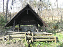
From Byniny to the terminal heading towards Krhová (K Černým) at the 'picture', continue straight to Rožnov at Dolní Paseky. In Paseky, turn left (at Mokrém). Continue in Mokrém towards Bačová. We will ascend near the Viktoria guesthouse, proceed a bit along the main road about 300 meters, then turn right under the pindulu. Climb up to the pindulu, turn right and continue along the forest path towards Trojanovice Ráztoka. Then along Knížecí to Pustevny. And now finally downhill towards Skalíková meadow and down to the Mír cottage in Rožnov, then following the cycling path to Val. Mezu.
- -:--
- Duration
- 71.5 km
- Distance
- 1,196 m
- Ascent
- 1,196 m
- Descent
- ---
- Avg. speed
- ---
- Max. altitude
Route quality
Waytypes & surfaces along the route
Waytypes
Track
30.7 km
(43 %)
Cycleway
14.3 km
(20 %)
Surfaces
Paved
43.6 km
(61 %)
Unpaved
1.4 km
(2 %)
Paved (undefined)
22.2 km
(31 %)
Asphalt
21.4 km
(30 %)
Route highlights
Points of interest along the route

Point of interest after 0.2 km
sportbar Bynina

Point of interest after 3.9 km
Jarošovka

Point of interest after 22.5 km
Restaurace (penzion Viktoria)

Point of interest after 24.7 km
Pindula sedlo (Koliba)

Point of interest after 31.9 km
Trojanovice Raztoka

Point of interest after 37.2 km
Pustevny

Point of interest after 39 km
Skalíková louka

Point of interest after 45.9 km
chata Mír

Point of interest after 70.4 km
Restaurace Šaman
Continue with Bikemap
Use, edit, or download this cycling route
You would like to ride Bynina - Dolní Paseky - Pindula - Raztoka - Pustevny - Rožnov - Val. Mez. - Bynina or customize it for your own trip? Here is what you can do with this Bikemap route:
Free features
- Save this route as favorite or in collections
- Copy & plan your own version of this route
- Sync your route with Garmin or Wahoo
Premium features
Free trial for 3 days, or one-time payment. More about Bikemap Premium.
- Navigate this route on iOS & Android
- Export a GPX / KML file of this route
- Create your custom printout (try it for free)
- Download this route for offline navigation
Discover more Premium features.
Get Bikemap PremiumFrom our community
Other popular routes starting in Valašské Meziříčí
 VM - Lešná - Poruba - Vysoká - Hustopeče - VM
- Distance
- 29.9 km
- Ascent
- 134 m
- Descent
- 139 m
- Location
- Valašské Meziříčí, Zlín, Czechia
 TM_II_VM_Hranice_Starý Jičín_VM
- Distance
- 75.9 km
- Ascent
- 387 m
- Descent
- 390 m
- Location
- Valašské Meziříčí, Zlín, Czechia
 Seifertova do Seifertova
- Distance
- 60.6 km
- Ascent
- 539 m
- Descent
- 588 m
- Location
- Valašské Meziříčí, Zlín, Czechia
 kater
kater- Distance
- 52.5 km
- Ascent
- 530 m
- Descent
- 484 m
- Location
- Valašské Meziříčí, Zlín, Czechia
 Bynina - Velký Javorník - Bynina (okruh)
- Distance
- 38.2 km
- Ascent
- 879 m
- Descent
- 872 m
- Location
- Valašské Meziříčí, Zlín, Czechia
 Kolem muničního skladu
- Distance
- 14.5 km
- Ascent
- 240 m
- Descent
- 238 m
- Location
- Valašské Meziříčí, Zlín, Czechia
 TM_II_VM_Horní Bečva (priehrada)_VM
- Distance
- 62.1 km
- Ascent
- 317 m
- Descent
- 314 m
- Location
- Valašské Meziříčí, Zlín, Czechia
 Cestou necestou údolím Bečvy: Valašské Meziříčí - Teplice nad Bečvou
- Distance
- 24.8 km
- Ascent
- 38 m
- Descent
- 78 m
- Location
- Valašské Meziříčí, Zlín, Czechia
Open it in the app


