
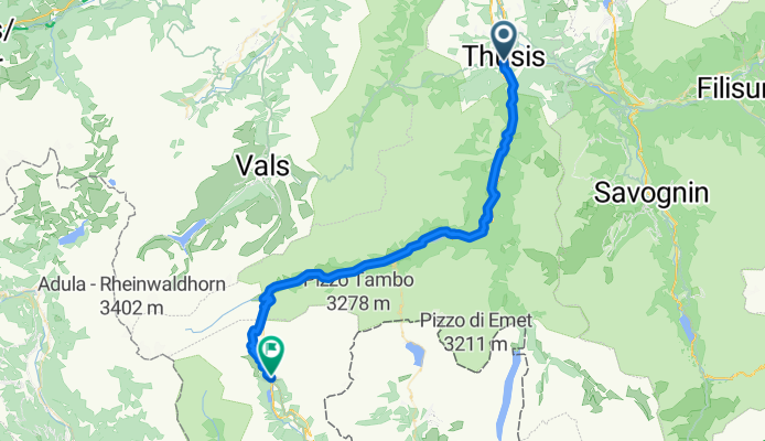
Thusis to San Bernardino
A cycling route starting in Thusis, Grisons, Switzerland.
Overview
About this route
- 3 h 43 min
- Duration
- 53.4 km
- Distance
- 2,304 m
- Ascent
- 1,412 m
- Descent
- 14.3 km/h
- Avg. speed
- 2,093 m
- Max. altitude

Route photos

Route quality
Waytypes & surfaces along the route
Waytypes
Track
9.6 km
(18 %)
Road
2.1 km
(4 %)
Surfaces
Paved
49.1 km
(92 %)
Unpaved
2.7 km
(5 %)
Asphalt
48.6 km
(91 %)
Gravel
2.7 km
(5 %)
Route highlights
Points of interest along the route

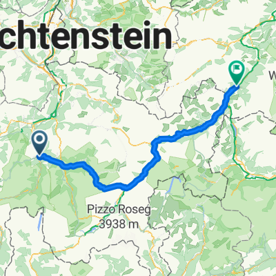
Point of interest after 46.1 km
Passo del San Bernardino 45km 1494m climb 3.0% av 10% max 2065m altitude
Continue with Bikemap
Use, edit, or download this cycling route
You would like to ride Thusis to San Bernardino or customize it for your own trip? Here is what you can do with this Bikemap route:
Free features
- Save this route as favorite or in collections
- Copy & plan your own version of this route
- Sync your route with Garmin or Wahoo
Premium features
Free trial for 3 days, or one-time payment. More about Bikemap Premium.
- Navigate this route on iOS & Android
- Export a GPX / KML file of this route
- Create your custom printout (try it for free)
- Download this route for offline navigation
Discover more Premium features.
Get Bikemap PremiumFrom our community
Other popular routes starting in Thusis
 3 Pässe, Albula, Maloja, Splügen
- Distance
- 172.1 km
- Ascent
- 6,572 m
- Descent
- 6,579 m
- Location
- Thusis, Grisons, Switzerland
 thusis __pfunds
- Distance
- 140.2 km
- Ascent
- 5,163 m
- Descent
- 4,916 m
- Location
- Thusis, Grisons, Switzerland
 TdL 3. Etappe
- Distance
- 130.2 km
- Ascent
- 1,251 m
- Descent
- 2,023 m
- Location
- Thusis, Grisons, Switzerland
 Route in Thusis
- Distance
- 41 km
- Ascent
- 591 m
- Descent
- 590 m
- Location
- Thusis, Grisons, Switzerland
 Scalottas-Tgatieni-Scalottas-Heidsee
- Distance
- 14.3 km
- Ascent
- 539 m
- Descent
- 1,311 m
- Location
- Thusis, Grisons, Switzerland
 Bergtour Beverin
- Distance
- 30.8 km
- Ascent
- 1,008 m
- Descent
- 1,008 m
- Location
- Thusis, Grisons, Switzerland
 ch12 Thusis - Felsberg - Bonaduz
- Distance
- 32.1 km
- Ascent
- 440 m
- Descent
- 472 m
- Location
- Thusis, Grisons, Switzerland
 Splügen-, Maloja- und Julierpass
- Distance
- 165.5 km
- Ascent
- 3,517 m
- Descent
- 3,519 m
- Location
- Thusis, Grisons, Switzerland
Open it in the app