

Standard Hill AFB Ride
A cycling route starting in Hill Air Force Base, Utah, United States.
Overview
About this route
Good ride route on Hill AFB. Largely traffic free. A few minor hills to get the blood pumping, but nothing too strenuous. Out and back makes a nice 21 mile trip. Do the golf course hill more times for more hill practice.
- -:--
- Duration
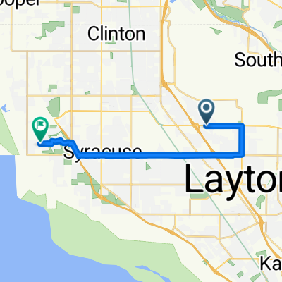
- 17.3 km
- Distance
- 80 m
- Ascent
- 125 m
- Descent
- ---
- Avg. speed
- 1,514 m
- Max. altitude
Route quality
Waytypes & surfaces along the route
Waytypes
Quiet road
15.7 km
(91 %)
Access road
0.5 km
(3 %)
Undefined
1 km
(6 %)
Surfaces
Paved
11.2 km
(65 %)
Asphalt
11.2 km
(65 %)
Undefined
6 km
(35 %)
Continue with Bikemap
Use, edit, or download this cycling route
You would like to ride Standard Hill AFB Ride or customize it for your own trip? Here is what you can do with this Bikemap route:
Free features
- Save this route as favorite or in collections
- Copy & plan your own version of this route
- Sync your route with Garmin or Wahoo
Premium features
Free trial for 3 days, or one-time payment. More about Bikemap Premium.
- Navigate this route on iOS & Android
- Export a GPX / KML file of this route
- Create your custom printout (try it for free)
- Download this route for offline navigation
Discover more Premium features.
Get Bikemap PremiumFrom our community
Other popular routes starting in Hill Air Force Base
 Standard Hill AFB Ride
- Distance
- 17.3 km
- Ascent
- 80 m
- Descent
- 125 m
- Location
- Hill Air Force Base, Utah, United States
 New Beginnings
- Distance
- 15 km
- Ascent
- 212 m
- Descent
- 212 m
- Location
- Hill Air Force Base, Utah, United States
 Recovered Route
- Distance
- 1 km
- Ascent
- 22 m
- Descent
- 3 m
- Location
- Hill Air Force Base, Utah, United States
 2485 N 1100 W, Layton to 1437–1457 S 400 W, Salt Lake City
- Distance
- 44.9 km
- Ascent
- 80 m
- Descent
- 179 m
- Location
- Hill Air Force Base, Utah, United States
 E 700 S, Clearfield to S 4100 W Cir, Syracuse
- Distance
- 15.7 km
- Ascent
- 66 m
- Descent
- 167 m
- Location
- Hill Air Force Base, Utah, United States
 E 700 S, Clearfield to S 4100 W Cir, Syracuse
- Distance
- 15.7 km
- Ascent
- 60 m
- Descent
- 167 m
- Location
- Hill Air Force Base, Utah, United States
 2426 N 75 E, Layton to 191–205 N West Promontory, Farmington
- Distance
- 16.4 km
- Ascent
- 10 m
- Descent
- 127 m
- Location
- Hill Air Force Base, Utah, United States
 2426 N 75 E, Layton to 2402 N 75 E, Layton
- Distance
- 2.9 km
- Ascent
- 35 m
- Descent
- 37 m
- Location
- Hill Air Force Base, Utah, United States
Open it in the app