
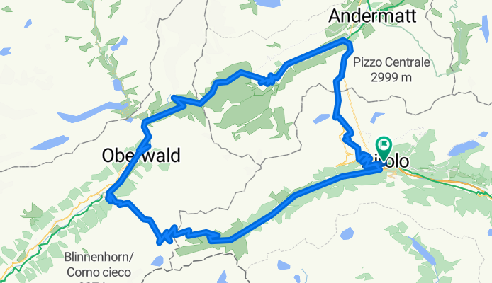
Airolo - St Gotthard Loop
A cycling route starting in Airolo, Canton Ticino, Switzerland.
Overview
About this route
- 7 h 48 min
- Duration
- 97.4 km
- Distance
- 3,382 m
- Ascent
- 3,382 m
- Descent
- 12.5 km/h
- Avg. speed
- 2,457 m
- Max. altitude

Route photos

Route quality
Waytypes & surfaces along the route
Waytypes
Quiet road
2.9 km
(3 %)
Track
2 km
(2 %)
Surfaces
Paved
83.9 km
(86 %)
Unpaved
2.8 km
(3 %)
Asphalt
82 km
(84 %)
Ground
1.6 km
(2 %)
Route highlights
Points of interest along the route
Point of interest after 2 km
Forte Airolo Museo Forte Airolo
Point of interest after 13 km
Museo Nazionale del San Gottardo
Point of interest after 13.1 km
Fort Hospiz
Point of interest after 13.2 km
Sasso San Gottardo Fort built into a mountain with tunnels and historical exhibits, open for individual and guided tours.

Point of interest after 13.6 km
St Gottard Pass 13.9km 946m climb 6.8% av 10% max 2107m altitude
Point of interest after 14.8 km
Staumauer Lago di Lucendro Dam
Point of interest after 20.8 km
Hospental Train Station
Point of interest after 23.2 km
Landschaftspanorama Furkastrasse
Point of interest after 27.1 km
Kapelle Lieg (Sankt Joseph)
Point of interest after 29.9 km
Goldfinger Furka Pass shot.
Point of interest after 37.3 km
Punto di osservazione cascate

Point of interest after 39.7 km
Furka Pass 12.4km 889m climb 7.2% av 11.0% max 2429m altitude
Point of interest after 40.1 km
Furka photo spot

Point of interest after 42.6 km
Belvedere bend
Point of interest after 43.4 km
The Rhöne Wasserfall features cascading waters that create a spectacular visual display, especially during the spring melt when water flow is at its peak. The waterfall plunges over rocky cliffs, creating a mist that adds to the enchanting atmosphere.
Point of interest after 50.4 km
Gletsch Train Station
Point of interest after 50.6 km
Anglikanische Kapelle Gletsch
Point of interest after 51.5 km
Rhone Bridge

Point of interest after 51.6 km
Grimsel Pass 6km 400m climb from Gletsch
Point of interest after 51.9 km
Rhone Rail Bridge

Point of interest after 72.6 km
Nufenen Pass 14.3km 1133m climb 7.9% av 12.5% max 2480m altitude
Continue with Bikemap
Use, edit, or download this cycling route
You would like to ride Airolo - St Gotthard Loop or customize it for your own trip? Here is what you can do with this Bikemap route:
Free features
- Save this route as favorite or in collections
- Copy & plan your own version of this route
- Split it into stages to create a multi-day tour
- Sync your route with Garmin or Wahoo
Premium features
Free trial for 3 days, or one-time payment. More about Bikemap Premium.
- Navigate this route on iOS & Android
- Export a GPX / KML file of this route
- Create your custom printout (try it for free)
- Download this route for offline navigation
Discover more Premium features.
Get Bikemap PremiumFrom our community
Other popular routes starting in Airolo
 Progetto N
- Distance
- 101.1 km
- Ascent
- 3,010 m
- Descent
- 3,010 m
- Location
- Airolo, Canton Ticino, Switzerland
 TORTOUR 2012 TS08-TS09
- Distance
- 80.1 km
- Ascent
- 2,023 m
- Descent
- 2,659 m
- Location
- Airolo, Canton Ticino, Switzerland
 Passo San Gottardo
- Distance
- 34.5 km
- Ascent
- 1,142 m
- Descent
- 1,134 m
- Location
- Airolo, Canton Ticino, Switzerland
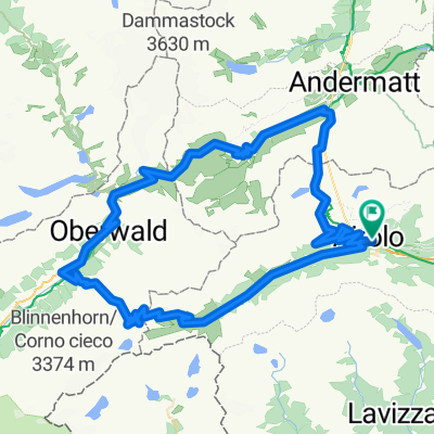
- Airolo - St Gotthard Loop
- Distance
- 97.4 km
- Ascent
- 3,382 m
- Descent
- 3,382 m
- Location
- Airolo, Canton Ticino, Switzerland
 Lago Ritom - Andermatt
- Distance
- 65.9 km
- Ascent
- 1,393 m
- Descent
- 1,774 m
- Location
- Airolo, Canton Ticino, Switzerland
 Passo della Novena
- Distance
- 35.4 km
- Ascent
- 1,259 m
- Descent
- 1,262 m
- Location
- Airolo, Canton Ticino, Switzerland
 Upper Leventina
- Distance
- 49.8 km
- Ascent
- 746 m
- Descent
- 1,596 m
- Location
- Airolo, Canton Ticino, Switzerland
 025 - 2014
- Distance
- 75 km
- Ascent
- 1,496 m
- Descent
- 2,088 m
- Location
- Airolo, Canton Ticino, Switzerland
Open it in the app