

RVB dag5 TRélon-Peruwelz
A cycling route starting in Trélon, Hauts-de-France, France.
Overview
About this route
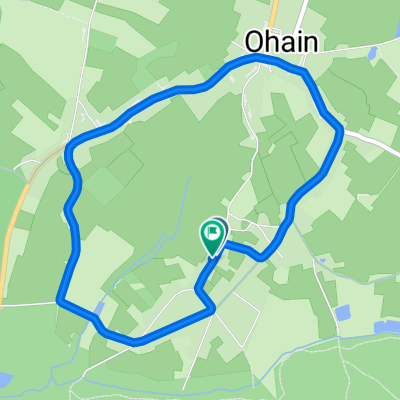
From Rue du Quartier du Tissage, 59132 Trélon, Hauts-de-France, France to Rue Bataille, 7600 Péruwelz, Belgium. Routing Road bike - the most beautiful.
- -:--
- Duration
- 127.7 km
- Distance
- 593 m
- Ascent
- 760 m
- Descent
- ---
- Avg. speed
- 230 m
- Max. altitude

Continue with Bikemap
Use, edit, or download this cycling route
You would like to ride RVB dag5 TRélon-Peruwelz or customize it for your own trip? Here is what you can do with this Bikemap route:
Free features
- Save this route as favorite or in collections
- Copy & plan your own version of this route
- Split it into stages to create a multi-day tour
- Sync your route with Garmin or Wahoo
Premium features
Free trial for 3 days, or one-time payment. More about Bikemap Premium.
- Navigate this route on iOS & Android
- Export a GPX / KML file of this route
- Create your custom printout (try it for free)
- Download this route for offline navigation
Discover more Premium features.
Get Bikemap PremiumFrom our community
Other popular routes starting in Trélon
 CC Val Joly Lompret
- Distance
- 61.8 km
- Ascent
- 294 m
- Descent
- 295 m
- Location
- Trélon, Hauts-de-France, France
 Val Joly - Petit tour
- Distance
- 37.7 km
- Ascent
- 261 m
- Descent
- 262 m
- Location
- Trélon, Hauts-de-France, France
 RVB dag5 TRélon-Peruwelz
- Distance
- 127.7 km
- Ascent
- 593 m
- Descent
- 760 m
- Location
- Trélon, Hauts-de-France, France
 CC Val Joly Maroilles
- Distance
- 67.8 km
- Ascent
- 238 m
- Descent
- 238 m
- Location
- Trélon, Hauts-de-France, France
 Val Joly - Tour du Lac du Val Joly
- Distance
- 18.7 km
- Ascent
- 315 m
- Descent
- 314 m
- Location
- Trélon, Hauts-de-France, France
 De ÄåÒ◊? à ÄåÒ◊?
- Distance
- 4.5 km
- Ascent
- 106 m
- Descent
- 114 m
- Location
- Trélon, Hauts-de-France, France
 Valjoly - Solre le Château (VTT)
- Distance
- 31.7 km
- Ascent
- 284 m
- Descent
- 284 m
- Location
- Trélon, Hauts-de-France, France
 CC Val Joly Lompret (camionettes)
- Distance
- 64.8 km
- Ascent
- 376 m
- Descent
- 374 m
- Location
- Trélon, Hauts-de-France, France
Open it in the app