
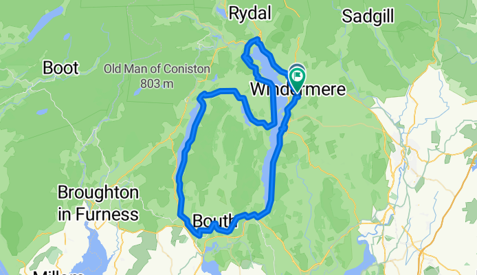
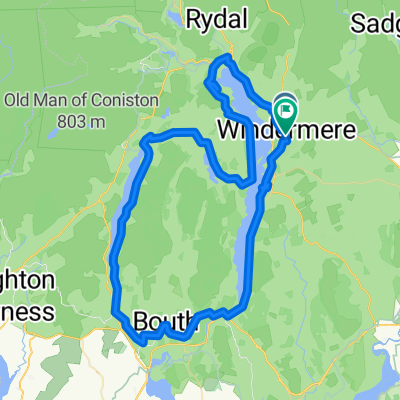
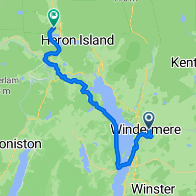
New file 1
A cycling route starting in Windermere, England, United Kingdom.
Overview
About this route
- -:--
- Duration
- 70.8 km
- Distance
- 1,160 m
- Ascent
- 1,163 m
- Descent
- ---
- Avg. speed
- 212 m
- Max. altitude

Continue with Bikemap
Use, edit, or download this cycling route
You would like to ride New file 1 or customize it for your own trip? Here is what you can do with this Bikemap route:
Free features
- Save this route as favorite or in collections
- Copy & plan your own version of this route
- Sync your route with Garmin or Wahoo
Premium features
Free trial for 3 days, or one-time payment. More about Bikemap Premium.
- Navigate this route on iOS & Android
- Export a GPX / KML file of this route
- Create your custom printout (try it for free)
- Download this route for offline navigation
Discover more Premium features.
Get Bikemap PremiumFrom our community
Other popular routes starting in Windermere
 Seed Howe, Kendal to Seed Howe, Kendal
- Distance
- 4.9 km
- Ascent
- 19 m
- Descent
- 19 m
- Location
- Windermere, England, United Kingdom
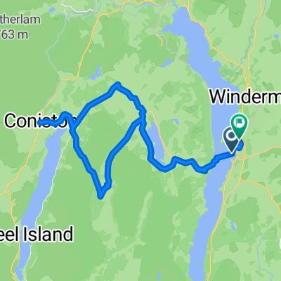 bowness coniston grizedale
- Distance
- 36.2 km
- Ascent
- 797 m
- Descent
- 794 m
- Location
- Windermere, England, United Kingdom
 New file 1
- Distance
- 70.8 km
- Ascent
- 1,160 m
- Descent
- 1,163 m
- Location
- Windermere, England, United Kingdom
 The Terrace to Red Lion Square
- Distance
- 24.9 km
- Ascent
- 433 m
- Descent
- 493 m
- Location
- Windermere, England, United Kingdom
 windermere golf club
- Distance
- 43.3 km
- Ascent
- 330 m
- Descent
- 331 m
- Location
- Windermere, England, United Kingdom
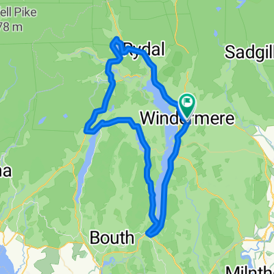 Lakes Loop
- Distance
- 62.9 km
- Ascent
- 602 m
- Descent
- 602 m
- Location
- Windermere, England, United Kingdom
 Lake Road 5, Bowness-on-Windermere do Windermere
- Distance
- 5.4 km
- Ascent
- 154 m
- Descent
- 199 m
- Location
- Windermere, England, United Kingdom
 9.6.2017 Anglie - The Lakes National Park
- Distance
- 54.9 km
- Ascent
- 526 m
- Descent
- 531 m
- Location
- Windermere, England, United Kingdom
Open it in the app