

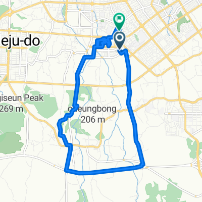
대원길, 제주시에서 대원길, 제주시까지
- 106.7 km
- 1,649 m
- 1,628 m
- Jeju City, Jeju-do, South Korea
A cycling route starting in Jeju City, Jeju-do, South Korea.
Overview
created this 5 months ago


Continue with Bikemap
You would like to ride 대원길, 제주시에서 대원길, 제주시까지 or customize it for your own trip? Here is what you can do with this Bikemap route:
Free trial for 3 days, or one-time payment. More about Bikemap Premium.
Discover more Premium features.
Get Bikemap PremiumFrom our community
Open it in the app
![Ph0]에서 경로월평동 999-1](https://media.bikemap.net/routes/17661112/staticmaps/in_de1b4110-ddf2-4014-9884-320b735ca591_400x400_bikemap-2021-3D-static.png)


![Ph0]에서 경로월평동 999-1](https://media.bikemap.net/routes/17659864/staticmaps/in_0eb7a881-14bb-4140-8e6e-4b92c59f2a49_400x400_bikemap-2021-3D-static.png)