

Atarfe - Huetor Tájar
A cycling route starting in Atarfe, Andalusia, Spain.
Overview
About this route
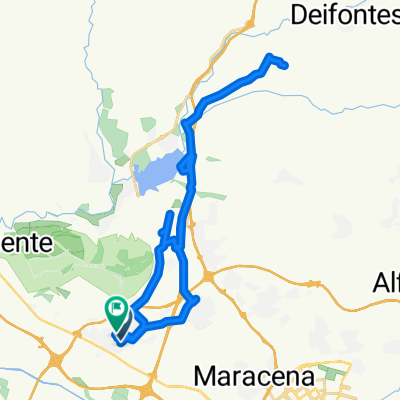
I pass through Fuentevaqueros, Valderrubio, Escóznar, Obeilar, Íllora, Alomartes, Tocón, and Villanueva de Mesía before reaching Huetor. Several slopes stand out, especially the climb to Íllora and a rise between Villanueva de Mesía and Tocón; other than that, it is generally a flat stage.
- -:--
- Duration
- 43.9 km
- Distance
- 205 m
- Ascent
- 311 m
- Descent
- ---
- Avg. speed
- ---
- Max. altitude

Route quality
Waytypes & surfaces along the route
Waytypes
Road
25.4 km
(58 %)
Quiet road
2.6 km
(6 %)
Undefined
15.8 km
(36 %)
Surfaces
Paved
41.7 km
(95 %)
Asphalt
41.2 km
(94 %)
Paved (undefined)
0.4 km
(1 %)
Undefined
2.2 km
(5 %)
Continue with Bikemap
Use, edit, or download this cycling route
You would like to ride Atarfe - Huetor Tájar or customize it for your own trip? Here is what you can do with this Bikemap route:
Free features
- Save this route as favorite or in collections
- Copy & plan your own version of this route
- Sync your route with Garmin or Wahoo
Premium features
Free trial for 3 days, or one-time payment. More about Bikemap Premium.
- Navigate this route on iOS & Android
- Export a GPX / KML file of this route
- Create your custom printout (try it for free)
- Download this route for offline navigation
Discover more Premium features.
Get Bikemap PremiumFrom our community
Other popular routes starting in Atarfe
 Atarfe Illora Montefrio Olivares
- Distance
- 108 km
- Ascent
- 1,256 m
- Descent
- 1,254 m
- Location
- Atarfe, Andalusia, Spain
 Atarfe - Cogollos - Atarfe
- Distance
- 44.6 km
- Ascent
- 547 m
- Descent
- 547 m
- Location
- Atarfe, Andalusia, Spain
 Atarfe - Huetor Tájar
- Distance
- 43.9 km
- Ascent
- 205 m
- Descent
- 311 m
- Location
- Atarfe, Andalusia, Spain
 Llano de la Perdiz, gracias Aguilera ^^.
- Distance
- 26.8 km
- Ascent
- 569 m
- Descent
- 295 m
- Location
- Atarfe, Andalusia, Spain
 De Calle Málaga a Calle Moreras
- Distance
- 37.2 km
- Ascent
- 342 m
- Descent
- 387 m
- Location
- Atarfe, Andalusia, Spain
 Se te pondrá malacara 100KM
- Distance
- 99.8 km
- Ascent
- 1,181 m
- Descent
- 1,181 m
- Location
- Atarfe, Andalusia, Spain
 Atarfe - Cogollos - Puerto Lobo - Atarfe
- Distance
- 68.1 km
- Ascent
- 1,102 m
- Descent
- 1,102 m
- Location
- Atarfe, Andalusia, Spain
 Atarfe-Pantano Cubillas-Maracanilla-Moleona-Atarfe
- Distance
- 32.2 km
- Ascent
- 364 m
- Descent
- 364 m
- Location
- Atarfe, Andalusia, Spain
Open it in the app