


Tour de France Etappe 8 Lanslebourg - Pinerolo
A cycling route starting in Modane, Auvergne-Rhône-Alpes, France.
Overview
About this route
0
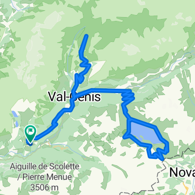
<span style="font-size: 7.0pt; line-height: 115%; font-family: "Verdana","sans-serif"; mso-fareast-font-family: "Times New Roman"; mso-bidi-font-family: "Times New Roman"; color: black; mso-ansi-language: DE-AT; mso-fareast-language: DE; mso-bidi-language: AR-SA;" lang="DE-AT">Lanslebourg (F) – Pinerolo (I)</span>
<span style="font-size: 7.0pt; line-height: 115%; font-family: "Verdana","sans-serif"; mso-fareast-font-family: "Times New Roman"; mso-bidi-font-family: "Times New Roman"; color: black; mso-ansi-language: EN-US; mso-fareast-language: DE; mso-bidi-language: AR-SA;" lang="EN-US">*Col du Mont Cenis (2.081 m)<br /> *Colle Braida (1.007 m)</span>
- -:--
- Duration
- 130.2 km
- Distance
- 1,675 m
- Ascent
- 2,936 m
- Descent
- ---
- Avg. speed
- ---
- Max. altitude
Arnold Wartinger
created this 13 years ago
Continue with Bikemap
Use, edit, or download this cycling route
You would like to ride Tour de France Etappe 8 Lanslebourg - Pinerolo or customize it for your own trip? Here is what you can do with this Bikemap route:
Free features
- Save this route as favorite or in collections
- Copy & plan your own version of this route
- Split it into stages to create a multi-day tour
- Sync your route with Garmin or Wahoo
Premium features
Free trial for 3 days, or one-time payment. More about Bikemap Premium.
- Navigate this route on iOS & Android
- Export a GPX / KML file of this route
- Create your custom printout (try it for free)
- Download this route for offline navigation
Discover more Premium features.
Get Bikemap PremiumFrom our community
Other popular routes starting in Modane

 Route des Grandes Alpes - Termignon to Valloire (7)1
- 51.5 km
- 925 m
- 808 m
- Modane, Auvergne-Rhône-Alpes, France


 Col de l'Iseran / Col du Mont Cenis / Bonus0
- 119.4 km
- 3,609 m
- 3,608 m
- Modane, Auvergne-Rhône-Alpes, France


Open it in the app