Gipfelrunde Harz
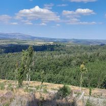
A cycling route starting in Benneckenstein, Saxony-Anhalt, Germany.
Overview
About this route
Dies ist eine Möglichkeit den Wurmberg und den Brocken innerhalb einer Tour zu verbinden.
- -:--
- Duration
- 94.4 km
- Distance
- 1,784 m
- Ascent
- 1,813 m
- Descent
- ---
- Avg. speed
- 1,138 m
- Avg. speed
Route quality
Waytypes & surfaces along the route
Waytypes
Busy road
36.7 km
(39 %)
Quiet road
30.5 km
(32 %)
Surfaces
Paved
78.8 km
(84 %)
Unpaved
10.1 km
(11 %)
Asphalt
78.4 km
(83 %)
Gravel
9.5 km
(10 %)
Continue with Bikemap
Use, edit, or download this cycling route
You would like to ride Gipfelrunde Harz or customize it for your own trip? Here is what you can do with this Bikemap route:
Free features
- Save this route as favorite or in collections
- Copy & plan your own version of this route
- Sync your route with Garmin or Wahoo
Premium features
Free trial for 3 days, or one-time payment. More about Bikemap Premium.
- Navigate this route on iOS & Android
- Export a GPX / KML file of this route
- Create your custom printout (try it for free)
- Download this route for offline navigation
Discover more Premium features.
Get Bikemap PremiumFrom our community
Other popular routes starting in Benneckenstein
- Grenzerfahrungen Teil 08 #BETA#
- Distance
- 55.9 km
- Ascent
- 756 m
- Descent
- 1,249 m
- Location
- Benneckenstein, Saxony-Anhalt, Germany
- 2025_Harz_Tanne-Wurmberg_57-1200
- Distance
- 56.5 km
- Ascent
- 1,163 m
- Descent
- 1,164 m
- Location
- Benneckenstein, Saxony-Anhalt, Germany
- Harz Tour 3. Tag - Sonntag
- Distance
- 127.3 km
- Ascent
- 1,872 m
- Descent
- 1,838 m
- Location
- Benneckenstein, Saxony-Anhalt, Germany
- Harz Tour 1. Tag - Freitag
- Distance
- 88.7 km
- Ascent
- 1,143 m
- Descent
- 1,207 m
- Location
- Benneckenstein, Saxony-Anhalt, Germany
- Hohegeiß - Bag Lauterberg - Braunlage - Hohegeiß 68 km 840HM
- Distance
- 68.1 km
- Ascent
- 682 m
- Descent
- 676 m
- Location
- Benneckenstein, Saxony-Anhalt, Germany
- 2025_Harz_Tanne_Wurmberg_58_1100
- Distance
- 58.9 km
- Ascent
- 1,047 m
- Descent
- 1,040 m
- Location
- Benneckenstein, Saxony-Anhalt, Germany
- Harz eher flache Strecke
- Distance
- 90.4 km
- Ascent
- 943 m
- Descent
- 943 m
- Location
- Benneckenstein, Saxony-Anhalt, Germany
- Harzer Roller
- Distance
- 158.9 km
- Ascent
- 1,257 m
- Descent
- 1,275 m
- Location
- Benneckenstein, Saxony-Anhalt, Germany
Open it in the app