

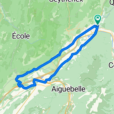
albertville via col matelaine coix faire st jean de maurienne
A cycling route starting in Albertville, Auvergne-Rhône-Alpes, France.
Overview
About this route
TdF 2012 11 stage
- -:--
- Duration
- 120.6 km
- Distance
- 3,393 m
- Ascent
- 3,158 m
- Descent
- ---
- Avg. speed
- ---
- Max. altitude
Route quality
Waytypes & surfaces along the route
Waytypes
Busy road
104.7 km
(87 %)
Quiet road
6.5 km
(5 %)
Surfaces
Paved
67.3 km
(56 %)
Asphalt
67.3 km
(56 %)
Undefined
53.3 km
(44 %)
Continue with Bikemap
Use, edit, or download this cycling route
You would like to ride albertville via col matelaine coix faire st jean de maurienne or customize it for your own trip? Here is what you can do with this Bikemap route:
Free features
- Save this route as favorite or in collections
- Copy & plan your own version of this route
- Split it into stages to create a multi-day tour
- Sync your route with Garmin or Wahoo
Premium features
Free trial for 3 days, or one-time payment. More about Bikemap Premium.
- Navigate this route on iOS & Android
- Export a GPX / KML file of this route
- Create your custom printout (try it for free)
- Download this route for offline navigation
Discover more Premium features.
Get Bikemap PremiumFrom our community
Other popular routes starting in Albertville
 Rhone-Alpes: Etappe 2
- Distance
- 75.1 km
- Ascent
- 1,903 m
- Descent
- 1,673 m
- Location
- Albertville, Auvergne-Rhône-Alpes, France
 2018-06-16 / Col de Montessuit + Col du Pré + Cormet de Roselend + Lac de la Gittaz
- Distance
- 88.4 km
- Ascent
- 2,021 m
- Descent
- 2,020 m
- Location
- Albertville, Auvergne-Rhône-Alpes, France
 Albertville, Col de l'Arpettaz, Albertville.
- Distance
- 60.6 km
- Ascent
- 1,285 m
- Descent
- 1,285 m
- Location
- Albertville, Auvergne-Rhône-Alpes, France
 La Combe de Savoie // Albertville - St Pierre d'Albigny
- Distance
- 54.4 km
- Ascent
- 435 m
- Descent
- 435 m
- Location
- Albertville, Auvergne-Rhône-Alpes, France
 Rue du Docteur Jean-Baptiste Mathias, Albertville to Esplanade de l'Hôtel de Ville, Annecy
- Distance
- 235.9 km
- Ascent
- 1,125 m
- Descent
- 1,016 m
- Location
- Albertville, Auvergne-Rhône-Alpes, France
 09-D. Albertville - Roche Béranger (151,2 Km)
- Distance
- 151.2 km
- Ascent
- 4,491 m
- Descent
- 3,035 m
- Location
- Albertville, Auvergne-Rhône-Alpes, France
 Tour de France 2016 - Stage 19
- Distance
- 154.5 km
- Ascent
- 3,656 m
- Descent
- 2,625 m
- Location
- Albertville, Auvergne-Rhône-Alpes, France
 D'ALBERTVILLE A ANNECY 50KMS ENVIRON
- Distance
- 46.5 km
- Ascent
- 199 m
- Descent
- 86 m
- Location
- Albertville, Auvergne-Rhône-Alpes, France
Open it in the app