
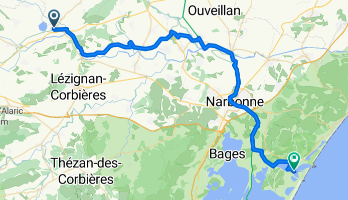
étape 7 Homps- Gruissan
A cycling route starting in Olonzac, Occitanie, France.
Overview
About this route
- 3 h 59 min
- Duration
- 55 km
- Distance
- 48 m
- Ascent
- 95 m
- Descent
- 13.8 km/h
- Avg. speed
- 51 m
- Max. altitude
Route quality
Waytypes & surfaces along the route
Waytypes
Quiet road
15.4 km
(28 %)
Path
15.4 km
(28 %)
Surfaces
Paved
23.6 km
(43 %)
Unpaved
24.2 km
(44 %)
Asphalt
23.1 km
(42 %)
Gravel
21.4 km
(39 %)
Continue with Bikemap
Use, edit, or download this cycling route
You would like to ride étape 7 Homps- Gruissan or customize it for your own trip? Here is what you can do with this Bikemap route:
Free features
- Save this route as favorite or in collections
- Copy & plan your own version of this route
- Sync your route with Garmin or Wahoo
Premium features
Free trial for 3 days, or one-time payment. More about Bikemap Premium.
- Navigate this route on iOS & Android
- Export a GPX / KML file of this route
- Create your custom printout (try it for free)
- Download this route for offline navigation
Discover more Premium features.
Get Bikemap PremiumFrom our community
Other popular routes starting in Olonzac
 Quai des Tonneliers to L'Écluse
- Distance
- 31.1 km
- Ascent
- 73 m
- Descent
- 40 m
- Location
- Olonzac, Occitanie, France
 Bordeaux 7
- Distance
- 26.5 km
- Ascent
- 40 m
- Descent
- 69 m
- Location
- Olonzac, Occitanie, France
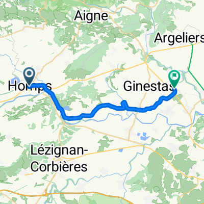
 1.5 Olonzac - Montagnac
- Distance
- 69.8 km
- Ascent
- 266 m
- Descent
- 286 m
- Location
- Olonzac, Occitanie, France
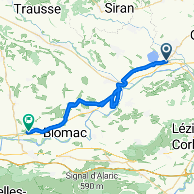
 Homps / Le Somail
- Distance
- 19.9 km
- Ascent
- 22 m
- Descent
- 40 m
- Location
- Olonzac, Occitanie, France
 variante-entre-homps-et-le-somail-via-minerve
- Distance
- 38.8 km
- Ascent
- 332 m
- Descent
- 349 m
- Location
- Olonzac, Occitanie, France
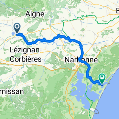 étape 7 Homps- Gruissan
- Distance
- 55 km
- Ascent
- 48 m
- Descent
- 95 m
- Location
- Olonzac, Occitanie, France
 Variante entre Homps et Le Somail, via Minerve
- Distance
- 39.5 km
- Ascent
- 957 m
- Descent
- 973 m
- Location
- Olonzac, Occitanie, France
 France minerve to rieux-minervois
- Distance
- 37.9 km
- Ascent
- 340 m
- Descent
- 450 m
- Location
- Olonzac, Occitanie, France
Open it in the app