
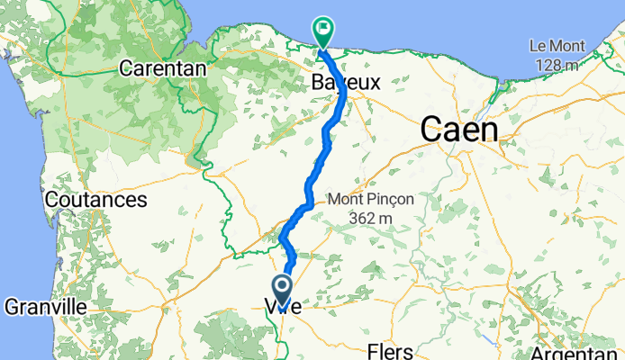
Velostour Tag 13: Rue Émile ZImmermann, Vire Normandie nach Chemin du Colombier, Port-en-Bessin-Huppain
A cycling route starting in Vire, Normandy, France.
Overview
About this route
- 4 h 23 min
- Duration
- 72.2 km
- Distance
- 744 m
- Ascent
- 873 m
- Descent
- 16.5 km/h
- Avg. speed
- 242 m
- Max. altitude
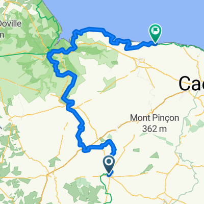
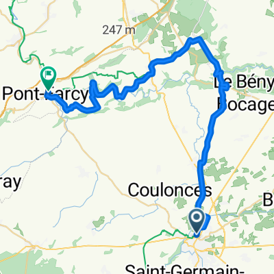
Route quality
Waytypes & surfaces along the route
Waytypes
Quiet road
31.8 km
(44 %)
Road
22.4 km
(31 %)
Surfaces
Paved
39 km
(54 %)
Unpaved
6.5 km
(9 %)
Asphalt
39 km
(54 %)
Gravel
5.8 km
(8 %)
Continue with Bikemap
Use, edit, or download this cycling route
You would like to ride Velostour Tag 13: Rue Émile ZImmermann, Vire Normandie nach Chemin du Colombier, Port-en-Bessin-Huppain or customize it for your own trip? Here is what you can do with this Bikemap route:
Free features
- Save this route as favorite or in collections
- Copy & plan your own version of this route
- Sync your route with Garmin or Wahoo
Premium features
Free trial for 3 days, or one-time payment. More about Bikemap Premium.
- Navigate this route on iOS & Android
- Export a GPX / KML file of this route
- Create your custom printout (try it for free)
- Download this route for offline navigation
Discover more Premium features.
Get Bikemap PremiumFrom our community
Other popular routes starting in Vire
 De Route de Pont-Farcy à Rue de la Planche
- Distance
- 5.4 km
- Ascent
- 35 m
- Descent
- 41 m
- Location
- Vire, Normandy, France
 Normandie 2
- Distance
- 183.7 km
- Ascent
- 1,472 m
- Descent
- 1,591 m
- Location
- Vire, Normandy, France
 Atlantic-Route 18. Etappe Vire-Normandie - Saint Grégoire
- Distance
- 68.2 km
- Ascent
- 702 m
- Descent
- 802 m
- Location
- Vire, Normandy, France
 2013/08/25 1. Tag Tour Vire - Baunatal (Vire-Liseux)
- Distance
- 104.8 km
- Ascent
- 703 m
- Descent
- 726 m
- Location
- Vire, Normandy, France
 VIRE - GRANVILLE
- Distance
- 124.6 km
- Ascent
- 510 m
- Descent
- 670 m
- Location
- Vire, Normandy, France
 Vire / Mont St Michel
- Distance
- 99.7 km
- Ascent
- 724 m
- Descent
- 808 m
- Location
- Vire, Normandy, France
 2009 1.Etappe Tour Vire - Sanse
- Distance
- 152.7 km
- Ascent
- 1,458 m
- Descent
- 1,544 m
- Location
- Vire, Normandy, France
 Vire Normandie / Pont-Farcy
- Distance
- 36.4 km
- Ascent
- 441 m
- Descent
- 507 m
- Location
- Vire, Normandy, France
Open it in the app