
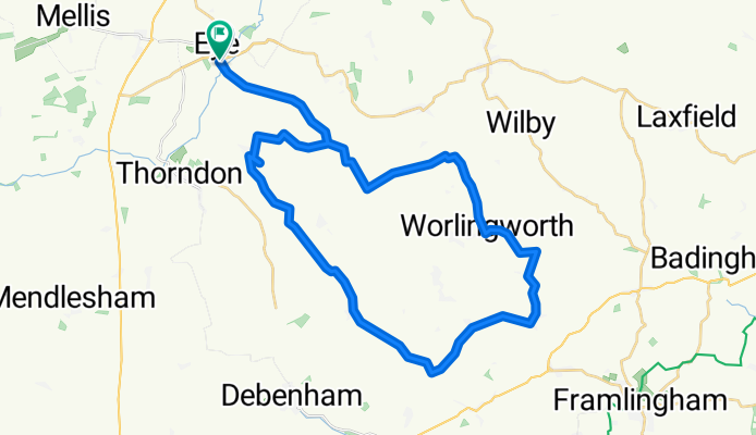
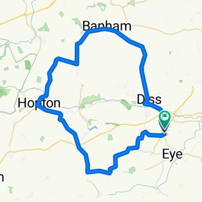
Lowgate Street to Lowgate Street
A cycling route starting in Diss, England, United Kingdom.
Overview
About this route
- 2 h 1 min
- Duration
- 39.4 km
- Distance
- 103 m
- Ascent
- 146 m
- Descent
- 19.5 km/h
- Avg. speed
- 77 m
- Max. altitude
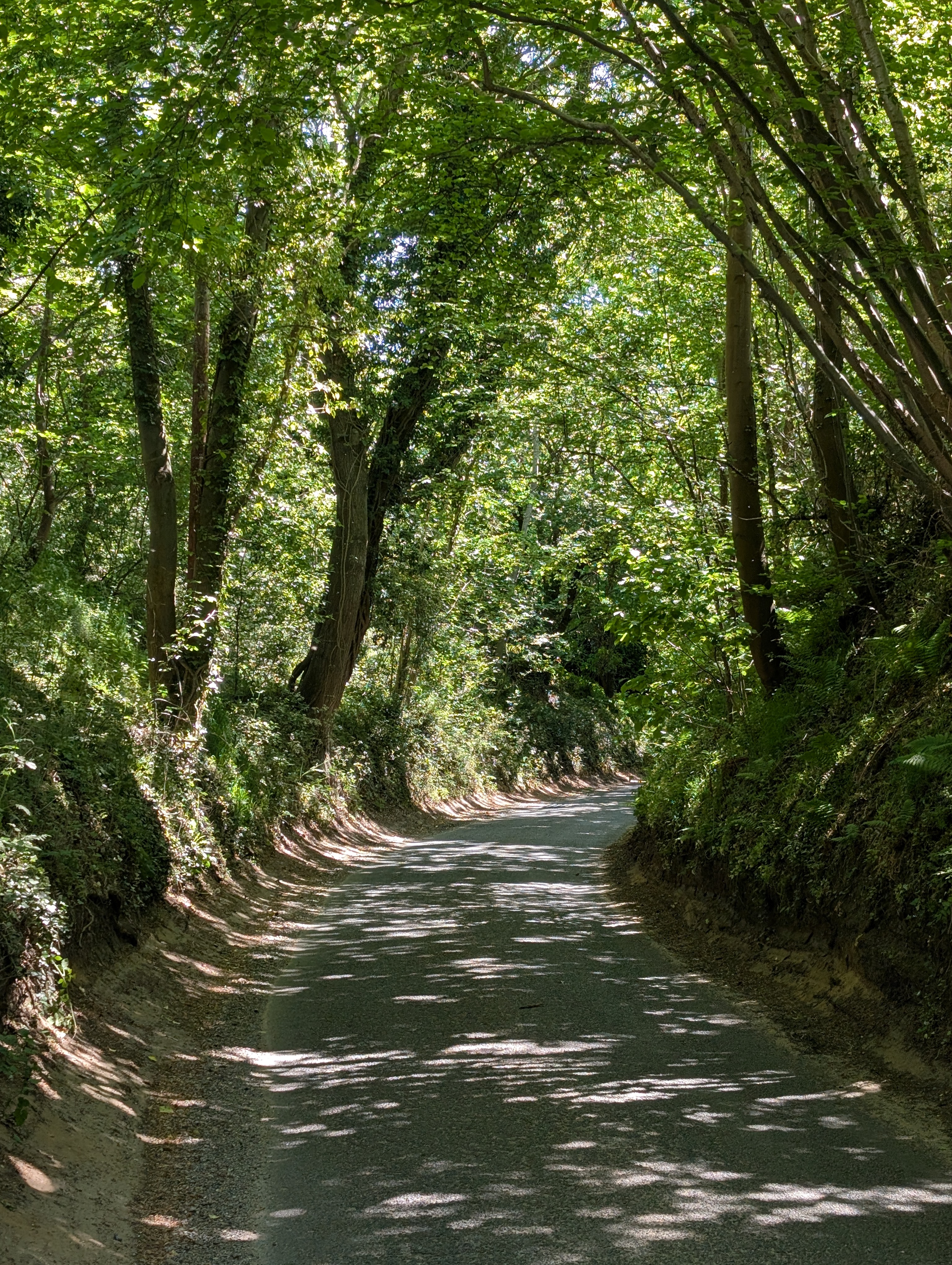
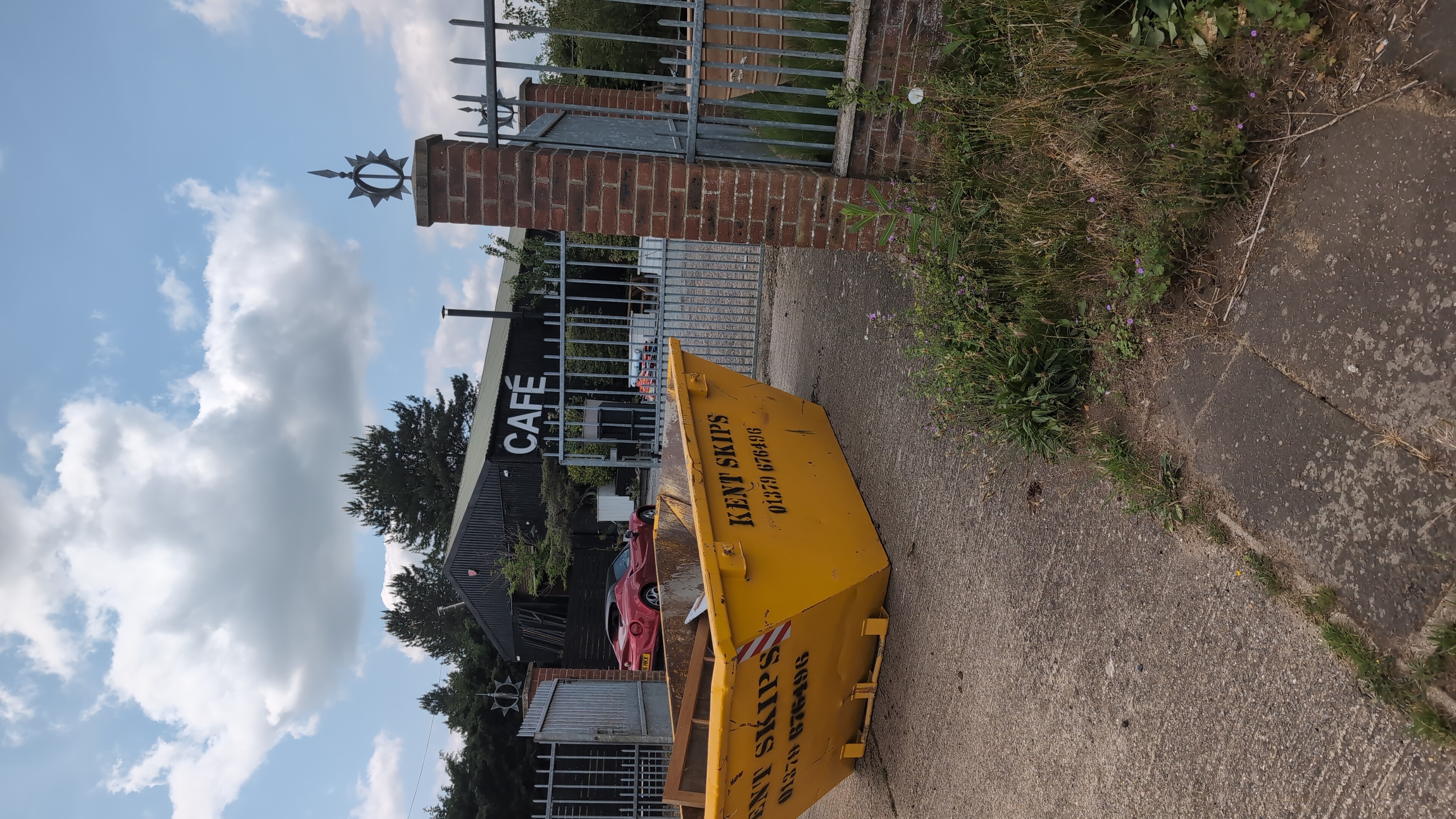
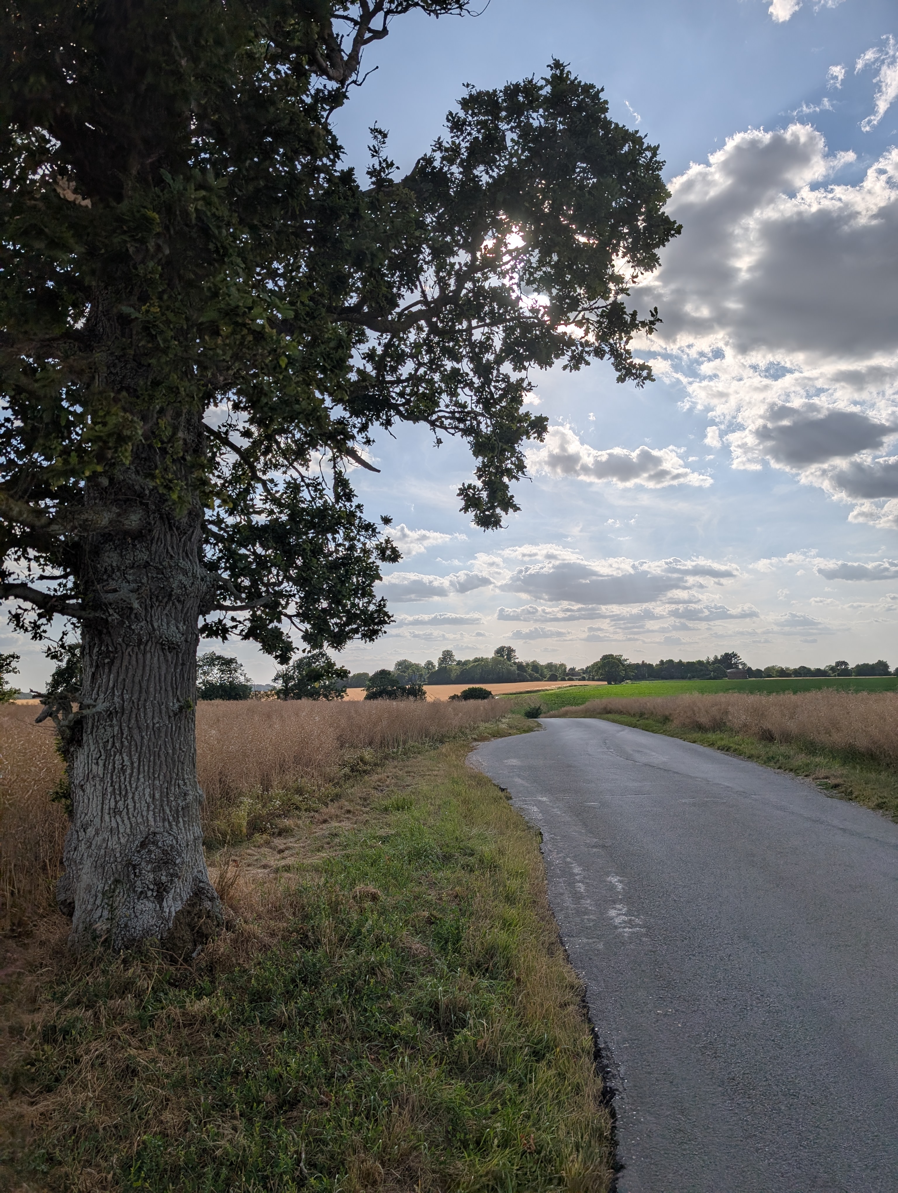
Route photos


Route quality
Waytypes & surfaces along the route
Waytypes
Road
27.7 km
(70 %)
Quiet road
9.4 km
(24 %)
Surfaces
Paved
2 km
(5 %)
Asphalt
2 km
(5 %)
Undefined
37.4 km
(95 %)
Continue with Bikemap
Use, edit, or download this cycling route
You would like to ride Lowgate Street to Lowgate Street or customize it for your own trip? Here is what you can do with this Bikemap route:
Free features
- Save this route as favorite or in collections
- Copy & plan your own version of this route
- Sync your route with Garmin or Wahoo
Premium features
Free trial for 3 days, or one-time payment. More about Bikemap Premium.
- Navigate this route on iOS & Android
- Export a GPX / KML file of this route
- Create your custom printout (try it for free)
- Download this route for offline navigation
Discover more Premium features.
Get Bikemap PremiumFrom our community
Other popular routes starting in Diss
 75km Out
- Distance
- 45.1 km
- Ascent
- 83 m
- Descent
- 95 m
- Location
- Diss, England, United Kingdom
 Lowgate Street to Lowgate Street
- Distance
- 60.8 km
- Ascent
- 269 m
- Descent
- 311 m
- Location
- Diss, England, United Kingdom
 Freshing Fields
- Distance
- 33.6 km
- Ascent
- 145 m
- Descent
- 191 m
- Location
- Diss, England, United Kingdom
 Toosdy trouble
- Distance
- 54.2 km
- Ascent
- 128 m
- Descent
- 130 m
- Location
- Diss, England, United Kingdom
 Diss to 303 Projects route 30
- Distance
- 69.9 km
- Ascent
- 197 m
- Descent
- 225 m
- Location
- Diss, England, United Kingdom
 Sunday Social Led Ride 1
- Distance
- 16.8 km
- Ascent
- 93 m
- Descent
- 94 m
- Location
- Diss, England, United Kingdom
 Saint and Sinner
- Distance
- 54.7 km
- Ascent
- 257 m
- Descent
- 254 m
- Location
- Diss, England, United Kingdom
 Diss 40
- Distance
- 66.6 km
- Ascent
- 149 m
- Descent
- 149 m
- Location
- Diss, England, United Kingdom
Open it in the app