
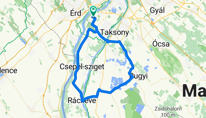
Halásztelek @70
A cycling route starting in Halásztelek, Pest County, Hungary.
Overview
About this route
70km-es kör Halásztelekről.
- -:--
- Duration
- 71.9 km
- Distance
- 27 m
- Ascent
- 24 m
- Descent
- ---
- Avg. speed
- ---
- Max. altitude

Route quality
Waytypes & surfaces along the route
Waytypes
Quiet road
9.3 km
(13 %)
Track
5.8 km
(8 %)
Surfaces
Paved
53.9 km
(75 %)
Unpaved
1.4 km
(2 %)
Asphalt
47.4 km
(66 %)
Concrete
6.5 km
(9 %)
Continue with Bikemap
Use, edit, or download this cycling route
You would like to ride Halásztelek @70 or customize it for your own trip? Here is what you can do with this Bikemap route:
Free features
- Save this route as favorite or in collections
- Copy & plan your own version of this route
- Sync your route with Garmin or Wahoo
Premium features
Free trial for 3 days, or one-time payment. More about Bikemap Premium.
- Navigate this route on iOS & Android
- Export a GPX / KML file of this route
- Create your custom printout (try it for free)
- Download this route for offline navigation
Discover more Premium features.
Get Bikemap PremiumFrom our community
Other popular routes starting in Halásztelek
 Körtefa utca, Halásztelek - Ló utca, Halásztelek
- Distance
- 20.1 km
- Ascent
- 9 m
- Descent
- 15 m
- Location
- Halásztelek, Pest County, Hungary
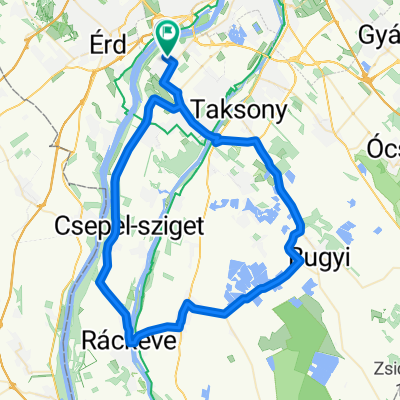
 Halásztelek - Ráckeve - Halásztelek
- Distance
- 58.7 km
- Ascent
- 4 m
- Descent
- 4 m
- Location
- Halásztelek, Pest County, Hungary
 Nagy Ócsa kör
- Distance
- 90 km
- Ascent
- 32 m
- Descent
- 30 m
- Location
- Halásztelek, Pest County, Hungary
 Bringázás Etyek felé
- Distance
- 76.6 km
- Ascent
- 468 m
- Descent
- 469 m
- Location
- Halásztelek, Pest County, Hungary
 Halásztelek @70
- Distance
- 71.9 km
- Ascent
- 27 m
- Descent
- 24 m
- Location
- Halásztelek, Pest County, Hungary
 Csepeli - kör
- Distance
- 35 km
- Ascent
- 20 m
- Descent
- 19 m
- Location
- Halásztelek, Pest County, Hungary
 Velence hosszú (Agárddal)
- Distance
- 129.7 km
- Ascent
- 591 m
- Descent
- 593 m
- Location
- Halásztelek, Pest County, Hungary
 Biatorbágy - Páty (síkon) - Pusztazámor
- Distance
- 87.6 km
- Ascent
- 332 m
- Descent
- 333 m
- Location
- Halásztelek, Pest County, Hungary
Open it in the app