
옥룡면 ~ 광양읍
A cycling route starting in Kwangyang, Jeollanam-do, South Korea.
Overview
About this route
- 2 h 27 min
- Duration
- 28.8 km
- Distance
- 389 m
- Ascent
- 350 m
- Descent
- 11.7 km/h
- Avg. speed
- 311 m
- Max. altitude

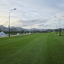
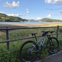
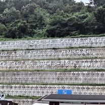
Route photos

Route quality
Waytypes & surfaces along the route
Waytypes
Road
23.9 km
(83 %)
Access road
3.2 km
(11 %)
Quiet road
1.7 km
(6 %)
Surfaces
Paved
4.6 km
(16 %)
Asphalt
4.6 km
(16 %)
Undefined
24.2 km
(84 %)
Continue with Bikemap
Use, edit, or download this cycling route
You would like to ride 옥룡면 ~ 광양읍 or customize it for your own trip? Here is what you can do with this Bikemap route:
Free features
- Save this route as favorite or in collections
- Copy & plan your own version of this route
- Sync your route with Garmin or Wahoo
Premium features
Free trial for 3 days, or one-time payment. More about Bikemap Premium.
- Navigate this route on iOS & Android
- Export a GPX / KML file of this route
- Create your custom printout (try it for free)
- Download this route for offline navigation
Discover more Premium features.
Get Bikemap PremiumFrom our community
Other popular routes starting in Kwangyang
 광양역-망덕포구-하동역 Gwang yang station-Mangdeok port-Hadong station 光陽站-望德浦口-河東站
- Distance
- 46.6 km
- Ascent
- 978 m
- Descent
- 977 m
- Location
- Kwangyang, Jeollanam-do, South Korea
 순천 동천 한바퀴
- Distance
- 39 km
- Ascent
- 310 m
- Descent
- 309 m
- Location
- Kwangyang, Jeollanam-do, South Korea
 진월면 252-12 ~ 진월면 252-8
- Distance
- 10.3 km
- Ascent
- 54 m
- Descent
- 63 m
- Location
- Kwangyang, Jeollanam-do, South Korea
![덕암동 159-5Ph0]으로 라우팅](https://media.bikemap.net/routes/17580530/gallery/thumbs/cd5bb6ba-bf53-44f9-b1ce-c199a6724e91.jpg.208x208_q80_crop.jpg) 덕암동 159-5Ph0]으로 라우팅
덕암동 159-5Ph0]으로 라우팅- Distance
- 41.5 km
- Ascent
- 318 m
- Descent
- 402 m
- Location
- Kwangyang, Jeollanam-do, South Korea
 진월면 120-2 ~ 진월면 120-2
- Distance
- 8.3 km
- Ascent
- 50 m
- Descent
- 80 m
- Location
- Kwangyang, Jeollanam-do, South Korea
 광양읍 상사호
- Distance
- 57.6 km
- Ascent
- 603 m
- Descent
- 579 m
- Location
- Kwangyang, Jeollanam-do, South Korea
 광양읍-순천제일대-호수공원
- Distance
- 36 km
- Ascent
- 293 m
- Descent
- 329 m
- Location
- Kwangyang, Jeollanam-do, South Korea
 D#16??
- Distance
- 88.2 km
- Ascent
- 1,558 m
- Descent
- 1,532 m
- Location
- Kwangyang, Jeollanam-do, South Korea
Open it in the app