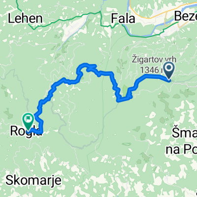
Od Ruševca do Ruške koče
A cycling route starting in Ruše, Ruše Municipality, Slovenia.
Overview
About this route
Pot nas vodi po makadamskih cestah mimo Mariborske koče in po grebeu Pohorja na Areh. Pri cerkvi nas čaka čudovit razgled na Podravje.
- -:--
- Duration
- 4.8 km
- Distance
- 244 m
- Ascent
- 100 m
- Descent
- ---
- Avg. speed
- ---
- Max. altitude
Route quality
Waytypes & surfaces along the route
Waytypes
Track
3 km
(63 %)
Quiet road
1.3 km
(27 %)
Surfaces
Paved
0.7 km
(14 %)
Unpaved
3.9 km
(81 %)
Ground
3 km
(63 %)
Gravel
0.8 km
(17 %)
Route highlights
Points of interest along the route
Point of interest after 0.2 km
Bar Jurček
Point of interest after 0.4 km
Mariborska koča
Point of interest after 0.8 km
Vojaška baza
Point of interest after 1.5 km
Smučišče Partizanka
Point of interest after 3.1 km
Dom na Glažuti
Point of interest after 4.3 km
Vodno zajetje
Point of interest after 4.5 km
Smučišče Areh
Continue with Bikemap
Use, edit, or download this cycling route
You would like to ride Od Ruševca do Ruške koče or customize it for your own trip? Here is what you can do with this Bikemap route:
Free features
- Save this route as favorite or in collections
- Copy & plan your own version of this route
- Sync your route with Garmin or Wahoo
Premium features
Free trial for 3 days, or one-time payment. More about Bikemap Premium.
- Navigate this route on iOS & Android
- Export a GPX / KML file of this route
- Create your custom printout (try it for free)
- Download this route for offline navigation
Discover more Premium features.
Get Bikemap PremiumFrom our community
Other popular routes starting in Ruše
- Lobniška riža tura s ŠD Pulz
- Distance
- 32.2 km
- Ascent
- 881 m
- Descent
- 881 m
- Location
- Ruše, Ruše Municipality, Slovenia
- Lobnica to Lukanja
- Distance
- 29 km
- Ascent
- 505 m
- Descent
- 735 m
- Location
- Ruše, Ruše Municipality, Slovenia
- Areh-Šumik-Klopni vrh-Pesek
- Distance
- 23.6 km
- Ascent
- 483 m
- Descent
- 351 m
- Location
- Ruše, Ruše Municipality, Slovenia
- Od Ruševca okrog Črnega jezera in Treh Kraljev
- Distance
- 41.9 km
- Ascent
- 814 m
- Descent
- 814 m
- Location
- Ruše, Ruše Municipality, Slovenia
- VI-Lj10a: Ruse - Pfarrdorf, 64,5km 1020hm
- Distance
- 64.5 km
- Ascent
- 1,348 m
- Descent
- 1,296 m
- Location
- Ruše, Ruše Municipality, Slovenia
- Od Apartmajske hiše Ruševec do pragozda in Slapov Šumik
- Distance
- 12.9 km
- Ascent
- 257 m
- Descent
- 431 m
- Location
- Ruše, Ruše Municipality, Slovenia
- Kolesarska pot od Ruševca do Planice nad Framom
- Distance
- 25.9 km
- Ascent
- 807 m
- Descent
- 807 m
- Location
- Ruše, Ruše Municipality, Slovenia
- Areh - Lovrenška jezera
- Distance
- 54.5 km
- Ascent
- 951 m
- Descent
- 941 m
- Location
- Ruše, Ruše Municipality, Slovenia
Open it in the app