
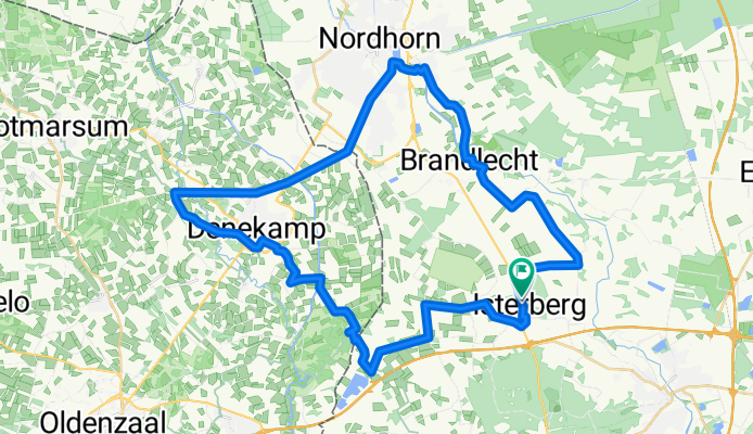

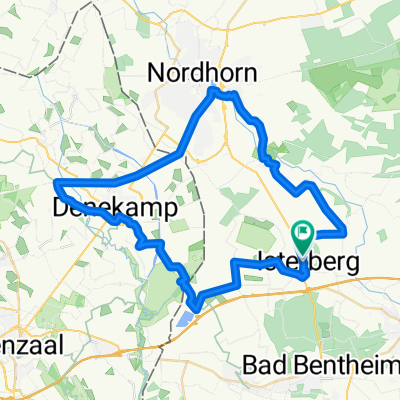
47,4 km Nordhorn-Denekamp-Hestrup
- 47.4 km
- 106 m
- 105 m
- Isterberg, Lower Saxony, Germany
A cycling route starting in Isterberg, Lower Saxony, Germany.
Overview
Through the Vechte Valley to Singgraven Castle / Length: approx. 47 km / The route: Nordhorn, Hesepe, Brandlecht, Hestrup, Neerlage, Isterberg, Wengsel, Syenvenn, Holt, Mekkelhorst, Denekamp, Nordhorn-Almelo Canal, Nordhorn
created this 5 months ago
Continue with Bikemap
You would like to ride 47,4 km Nordhorn-Denekamp-Hestrup or customize it for your own trip? Here is what you can do with this Bikemap route:
Free trial for 3 days, or one-time payment. More about Bikemap Premium.
Discover more Premium features.
Get Bikemap PremiumFrom our community
Open it in the app


