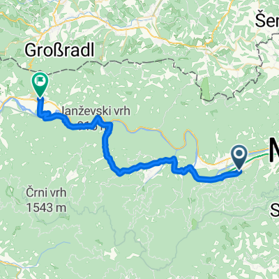
Od Ruševca na Klopni vrh
A cycling route starting in Ruše, Ruše Municipality, Slovenia.
Overview
About this route
Pot nas vodi po asfaltnih in makedamskih cestah mimo Mariborske koče, po grebenu Pohorja na Areh in naprej do naravnega rezervata Šumik. Tu se lahko peš odpravimo pogledat pragozd in slapova Veliki in Mali Šumik. Nadaljujemo po makadamskih cestah do Klopnega vrha od koder ov lepem vremenu vidi na Roglo, Dravsko dolino in Podravje. Zadnji del poti 200m je potrebno prehoditi po uhojeni peš poti na vrh
- -:--
- Duration
- 21.8 km
- Distance
- 623 m
- Ascent
- 439 m
- Descent
- ---
- Avg. speed
- ---
- Max. altitude
Route quality
Waytypes & surfaces along the route
Waytypes
Quiet road
9.5 km
(44 %)
Track
6.9 km
(31 %)
Surfaces
Paved
5.8 km
(27 %)
Unpaved
15.9 km
(73 %)
Gravel
7.5 km
(34 %)
Unpaved (undefined)
5.6 km
(26 %)
Route highlights
Points of interest along the route
Point of interest after 0.4 km
Mariborska koča
Point of interest after 4.9 km
Ruška koča
Accommodation after 5 km
Hotel Areh
Point of interest after 11.5 km
Slap Mali Šumik
Point of interest after 11.9 km
Slap Veliki Šumik
Continue with Bikemap
Use, edit, or download this cycling route
You would like to ride Od Ruševca na Klopni vrh or customize it for your own trip? Here is what you can do with this Bikemap route:
Free features
- Save this route as favorite or in collections
- Copy & plan your own version of this route
- Sync your route with Garmin or Wahoo
Premium features
Free trial for 3 days, or one-time payment. More about Bikemap Premium.
- Navigate this route on iOS & Android
- Export a GPX / KML file of this route
- Create your custom printout (try it for free)
- Download this route for offline navigation
Discover more Premium features.
Get Bikemap PremiumFrom our community
Other popular routes starting in Ruše
- Areh-Rogla-Areh
- Distance
- 48.8 km
- Ascent
- 1,078 m
- Descent
- 1,088 m
- Location
- Ruše, Ruše Municipality, Slovenia
- Od Ruševca okrog Črnega jezera in Treh Kraljev
- Distance
- 41.9 km
- Ascent
- 814 m
- Descent
- 814 m
- Location
- Ruše, Ruše Municipality, Slovenia
- Od Ruševca okrog Črnega jezera in Treh Kraljev
- Distance
- 45.4 km
- Ascent
- 837 m
- Descent
- 900 m
- Location
- Ruše, Ruše Municipality, Slovenia
- Kolesarska pot od Ruševca do Planice nad Framom
- Distance
- 25.9 km
- Ascent
- 807 m
- Descent
- 807 m
- Location
- Ruše, Ruše Municipality, Slovenia
- Nočni pohod
- Distance
- 5.1 km
- Ascent
- 285 m
- Descent
- 288 m
- Location
- Ruše, Ruše Municipality, Slovenia
- Lobniška riža tura s ŠD Pulz
- Distance
- 32.2 km
- Ascent
- 881 m
- Descent
- 881 m
- Location
- Ruše, Ruše Municipality, Slovenia
- Lobnica to Lukanja
- Distance
- 29 km
- Ascent
- 505 m
- Descent
- 735 m
- Location
- Ruše, Ruše Municipality, Slovenia
- Areh-Šumik-Klopni vrh-Pesek
- Distance
- 23.6 km
- Ascent
- 483 m
- Descent
- 351 m
- Location
- Ruše, Ruše Municipality, Slovenia
Open it in the app