
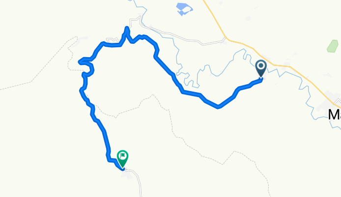
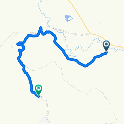
Tecuani-Cabos
A cycling route starting in Mascota, Jalisco, Mexico.
Overview
About this route
- 1 h 17 min
- Duration
- 18.1 km
- Distance
- 309 m
- Ascent
- 432 m
- Descent
- 14.1 km/h
- Avg. speed
- 1,337 m
- Max. altitude

Route quality
Waytypes & surfaces along the route
Waytypes
Quiet road
8.6 km
(48 %)
Road
8 km
(44 %)
Surfaces
Unpaved
8.4 km
(47 %)
Unpaved (undefined)
8.4 km
(47 %)
Undefined
9.7 km
(53 %)
Continue with Bikemap
Use, edit, or download this cycling route
You would like to ride Tecuani-Cabos or customize it for your own trip? Here is what you can do with this Bikemap route:
Free features
- Save this route as favorite or in collections
- Copy & plan your own version of this route
- Sync your route with Garmin or Wahoo
Premium features
Free trial for 3 days, or one-time payment. More about Bikemap Premium.
- Navigate this route on iOS & Android
- Export a GPX / KML file of this route
- Create your custom printout (try it for free)
- Download this route for offline navigation
Discover more Premium features.
Get Bikemap PremiumFrom our community
Other popular routes starting in Mascota
 Tecuani-Cabos
- Distance
- 18.1 km
- Ascent
- 309 m
- Descent
- 432 m
- Location
- Mascota, Jalisco, Mexico
 Mascota Pto Vallarta
- Distance
- 85.4 km
- Ascent
- 844 m
- Descent
- 2,048 m
- Location
- Mascota, Jalisco, Mexico
 Mascota a Vallarta
- Distance
- 92 km
- Ascent
- 702 m
- Descent
- 1,932 m
- Location
- Mascota, Jalisco, Mexico
 Ruta tranquila en Talpa de Allende
- Distance
- 33 km
- Ascent
- 528 m
- Descent
- 597 m
- Location
- Mascota, Jalisco, Mexico
 Mascota Cycling
- Distance
- 67 km
- Ascent
- 1,327 m
- Descent
- 2,423 m
- Location
- Mascota, Jalisco, Mexico
Open it in the app