
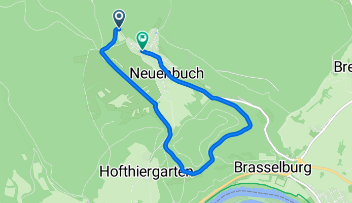
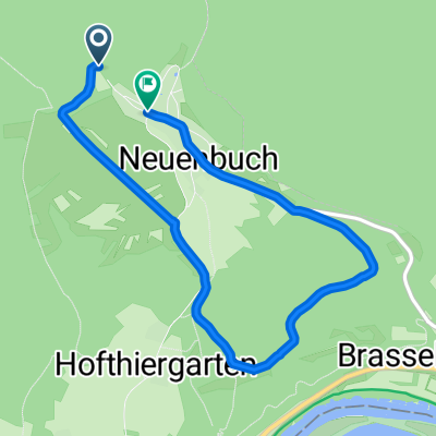
Ruheforst Runde ohne S-Kurve
A cycling route starting in Neunkirchen, Bavaria, Germany.
Overview
About this route
- 19 min
- Duration
- 5.5 km
- Distance
- 78 m
- Ascent
- 121 m
- Descent
- 16.8 km/h
- Avg. speed
- 327 m
- Max. altitude

Route quality
Waytypes & surfaces along the route
Waytypes
Track
2.2 km
(41 %)
Access road
1.3 km
(23 %)
Surfaces
Paved
2.5 km
(46 %)
Unpaved
2.2 km
(41 %)
Asphalt
2.5 km
(46 %)
Gravel
1.4 km
(26 %)
Continue with Bikemap
Use, edit, or download this cycling route
You would like to ride Ruheforst Runde ohne S-Kurve or customize it for your own trip? Here is what you can do with this Bikemap route:
Free features
- Save this route as favorite or in collections
- Copy & plan your own version of this route
- Sync your route with Garmin or Wahoo
Premium features
Free trial for 3 days, or one-time payment. More about Bikemap Premium.
- Navigate this route on iOS & Android
- Export a GPX / KML file of this route
- Create your custom printout (try it for free)
- Download this route for offline navigation
Discover more Premium features.
Get Bikemap PremiumFrom our community
Other popular routes starting in Neunkirchen
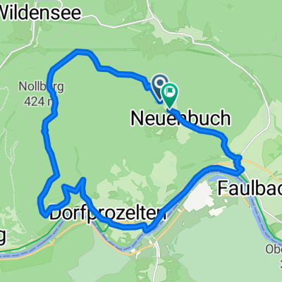 NB- Schutzhütte Prozele- Stadtprozelten - Nb
- Distance
- 20.1 km
- Ascent
- 373 m
- Descent
- 422 m
- Location
- Neunkirchen, Bavaria, Germany
 Gamburg-Külsheim
- Distance
- 72.4 km
- Ascent
- 539 m
- Descent
- 539 m
- Location
- Neunkirchen, Bavaria, Germany
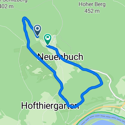 S-Kurve-Ruheforst-zurück
- Distance
- 6.4 km
- Ascent
- 112 m
- Descent
- 147 m
- Location
- Neunkirchen, Bavaria, Germany
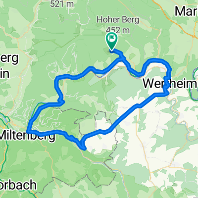 Miltenberg-Eichenbühl-Wertheim-Neuenbuch
- Distance
- 62.3 km
- Ascent
- 538 m
- Descent
- 538 m
- Location
- Neunkirchen, Bavaria, Germany
 Ruheforst Runde ohne S-Kurve
- Distance
- 5.5 km
- Ascent
- 78 m
- Descent
- 121 m
- Location
- Neunkirchen, Bavaria, Germany
 Neuenbucher Straße 19, Stadtprozelten nach Neuenbucher Straße 19, Stadtprozelten
- Distance
- 7.2 km
- Ascent
- 219 m
- Descent
- 216 m
- Location
- Neunkirchen, Bavaria, Germany
 Route nach Neuenbucher Straße 19, Stadtprozelten
- Distance
- 5.9 km
- Ascent
- 138 m
- Descent
- 137 m
- Location
- Neunkirchen, Bavaria, Germany
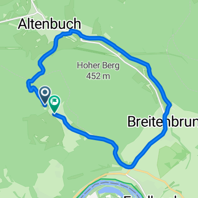 nb- Altenbuch - bb
- Distance
- 11.1 km
- Ascent
- 219 m
- Descent
- 257 m
- Location
- Neunkirchen, Bavaria, Germany
Open it in the app