
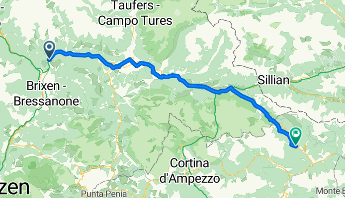
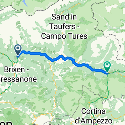
From Mühlbach to Comelico Superiore
A cycling route starting in Mühlbach, Trentino-Alto Adige, Italy.
Overview
About this route
- 5 h 52 min
- Duration
- 86.8 km
- Distance
- 2,147 m
- Ascent
- 1,705 m
- Descent
- 14.8 km/h
- Avg. speed
- 1,650 m
- Max. altitude
Route quality
Waytypes & surfaces along the route
Waytypes
Track
24.3 km
(28 %)
Quiet road
20.8 km
(24 %)
Surfaces
Paved
54.7 km
(63 %)
Unpaved
22.6 km
(26 %)
Asphalt
53.8 km
(62 %)
Gravel
14.8 km
(17 %)
Continue with Bikemap
Use, edit, or download this cycling route
You would like to ride From Mühlbach to Comelico Superiore or customize it for your own trip? Here is what you can do with this Bikemap route:
Free features
- Save this route as favorite or in collections
- Copy & plan your own version of this route
- Split it into stages to create a multi-day tour
- Sync your route with Garmin or Wahoo
Premium features
Free trial for 3 days, or one-time payment. More about Bikemap Premium.
- Navigate this route on iOS & Android
- Export a GPX / KML file of this route
- Create your custom printout (try it for free)
- Download this route for offline navigation
Discover more Premium features.
Get Bikemap PremiumFrom our community
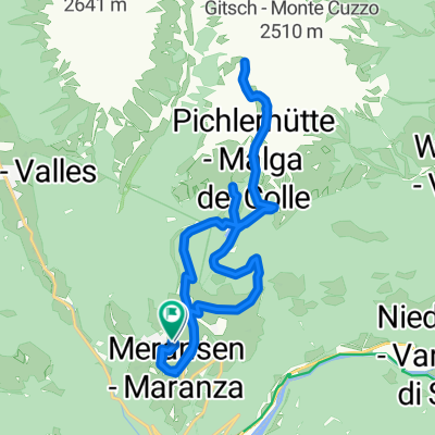
Other popular routes starting in Mühlbach
 Leitensteig. NICHT fürs MTB!!
- Distance
- 5.3 km
- Ascent
- 134 m
- Descent
- 232 m
- Location
- Mühlbach, Trentino-Alto Adige, Italy
 Kösslergasse, Rio di Pusteria to Kösslergasse, Rio di Pusteria
- Distance
- 19.9 km
- Ascent
- 960 m
- Descent
- 957 m
- Location
- Mühlbach, Trentino-Alto Adige, Italy
 MTB-Flach: Etappe04 HA-IBK: Mühlbach-Eisacktalradweg-Brenner-Innsbruck
- Distance
- 83.6 km
- Ascent
- 877 m
- Descent
- 720 m
- Location
- Mühlbach, Trentino-Alto Adige, Italy
 6. Muehlbach- Toblach
- Distance
- 49.8 km
- Ascent
- 750 m
- Descent
- 318 m
- Location
- Mühlbach, Trentino-Alto Adige, Italy
 Stöcklvaterweg nach Via Scaleres
- Distance
- 15.7 km
- Ascent
- 350 m
- Descent
- 505 m
- Location
- Mühlbach, Trentino-Alto Adige, Italy
 From Mühlbach to Toblach
- Distance
- 55 km
- Ascent
- 1,362 m
- Descent
- 918 m
- Location
- Mühlbach, Trentino-Alto Adige, Italy
 Dolomiten Tag 1
- Distance
- 93.1 km
- Ascent
- 1,657 m
- Descent
- 867 m
- Location
- Mühlbach, Trentino-Alto Adige, Italy
 Spinges - Stoanamandl - Panoramaweg
- Distance
- 17 km
- Ascent
- 804 m
- Descent
- 799 m
- Location
- Mühlbach, Trentino-Alto Adige, Italy
Open it in the app