
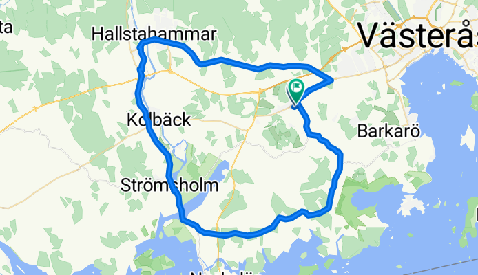
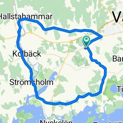
Albertusvägen, Västerås to Ekebyvägen, Västerås
A cycling route starting in Kolbäck, Västmanland County, Sweden.
Overview
About this route
- 2 h 17 min
- Duration
- 50.3 km
- Distance
- 192 m
- Ascent
- 197 m
- Descent
- 22 km/h
- Avg. speed
- 34 m
- Max. altitude
Route quality
Waytypes & surfaces along the route
Waytypes
Road
17.1 km
(34 %)
Cycleway
11.1 km
(22 %)
Surfaces
Paved
49.8 km
(99 %)
Asphalt
49.8 km
(99 %)
Undefined
0.5 km
(1 %)
Continue with Bikemap
Use, edit, or download this cycling route
You would like to ride Albertusvägen, Västerås to Ekebyvägen, Västerås or customize it for your own trip? Here is what you can do with this Bikemap route:
Free features
- Save this route as favorite or in collections
- Copy & plan your own version of this route
- Sync your route with Garmin or Wahoo
Premium features
Free trial for 3 days, or one-time payment. More about Bikemap Premium.
- Navigate this route on iOS & Android
- Export a GPX / KML file of this route
- Create your custom printout (try it for free)
- Download this route for offline navigation
Discover more Premium features.
Get Bikemap PremiumFrom our community
Other popular routes starting in Kolbäck
 Kolbäck-Julita
- Distance
- 66 km
- Ascent
- 201 m
- Descent
- 186 m
- Location
- Kolbäck, Västmanland County, Sweden
 ECT2020-T22 MälarenRunt Dag 2
- Distance
- 157.5 km
- Ascent
- 1,216 m
- Descent
- 1,200 m
- Location
- Kolbäck, Västmanland County, Sweden
 ECT2020 Mälaren norra
- Distance
- 145.5 km
- Ascent
- 240 m
- Descent
- 241 m
- Location
- Kolbäck, Västmanland County, Sweden
 Albertusvägen, Västerås to Ekebyvägen, Västerås
- Distance
- 50.3 km
- Ascent
- 192 m
- Descent
- 197 m
- Location
- Kolbäck, Västmanland County, Sweden
 Tingshusgatan 21 to Tingshusgatan 21
- Distance
- 75.4 km
- Ascent
- 413 m
- Descent
- 416 m
- Location
- Kolbäck, Västmanland County, Sweden
 Eriksbergsvägen 7–9, Hallstahammar to Västtunagatan 7, Hallstahammar
- Distance
- 4.1 km
- Ascent
- 16 m
- Descent
- 0 m
- Location
- Kolbäck, Västmanland County, Sweden
 Oskarsborgsvägen 37, Strömsholm to Oskarsborgsvägen 37, Strömsholm
- Distance
- 11.9 km
- Ascent
- 135 m
- Descent
- 133 m
- Location
- Kolbäck, Västmanland County, Sweden
 SC 0200-0250
- Distance
- 50 km
- Ascent
- 173 m
- Descent
- 148 m
- Location
- Kolbäck, Västmanland County, Sweden
Open it in the app