
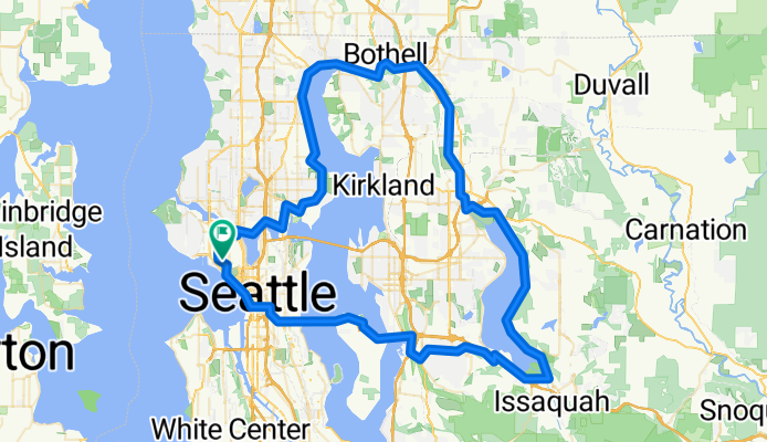
Seattle through Woodinville and Marymoor Park, around Lake Sammamish, and Return from Issaquah over Mercer Island
A cycling route starting in Seattle, Washington, United States.
Overview
About this route
This is a great ride with a large portion of it on dedicated paved bicycle trails and roads with bike lanes. We highly recommend this ride.
The ride passes park rest room facilities at Log Boom Park near Kenmore, at the Woodinville Wilmot Gateway Park, at Marymoor Park, and on Mercer Island at Aubrey Davis Park.
- 6 h 15 min
- Duration
- 95.7 km
- Distance
- 874 m
- Ascent
- 874 m
- Descent
- 15.3 km/h
- Avg. speed
- 155 m
- Max. altitude

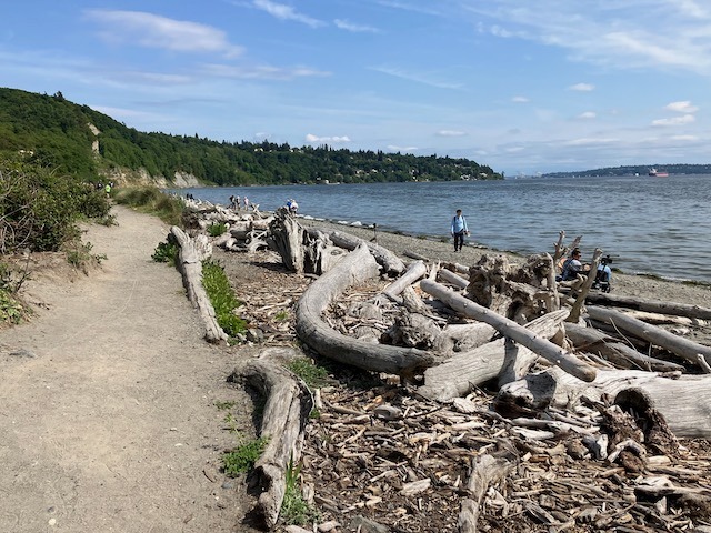
Route photos


Route quality
Waytypes & surfaces along the route
Waytypes
Cycleway
67 km
(70 %)
Road
8.6 km
(9 %)
Surfaces
Paved
85.1 km
(89 %)
Asphalt
65.1 km
(68 %)
Concrete
10.5 km
(11 %)
Continue with Bikemap
Use, edit, or download this cycling route
You would like to ride Seattle through Woodinville and Marymoor Park, around Lake Sammamish, and Return from Issaquah over Mercer Island or customize it for your own trip? Here is what you can do with this Bikemap route:
Free features
- Save this route as favorite or in collections
- Copy & plan your own version of this route
- Split it into stages to create a multi-day tour
- Sync your route with Garmin or Wahoo
Premium features
Free trial for 3 days, or one-time payment. More about Bikemap Premium.
- Navigate this route on iOS & Android
- Export a GPX / KML file of this route
- Create your custom printout (try it for free)
- Download this route for offline navigation
Discover more Premium features.
Get Bikemap PremiumFrom our community
Other popular routes starting in Seattle
 Snoqualmie Loop
- Distance
- 117 km
- Ascent
- 824 m
- Descent
- 824 m
- Location
- Seattle, Washington, United States
 2802 NW 61st St, Seattle to 2811 NW 61st St, Seattle
- Distance
- 61.5 km
- Ascent
- 6 m
- Descent
- 35 m
- Location
- Seattle, Washington, United States
 Cedar River Trail to Snoqualmie to Home
- Distance
- 124.9 km
- Ascent
- 824 m
- Descent
- 839 m
- Location
- Seattle, Washington, United States
 Magnolia/Discovery Park Hidden Areas and Great Climbs
- Distance
- 34.9 km
- Ascent
- 530 m
- Descent
- 530 m
- Location
- Seattle, Washington, United States
 Anderson Classic
- Distance
- 95.9 km
- Ascent
- 1,022 m
- Descent
- 1,030 m
- Location
- Seattle, Washington, United States
 Lake Washington Route
- Distance
- 88.7 km
- Ascent
- 495 m
- Descent
- 512 m
- Location
- Seattle, Washington, United States
 1/2 of Lake Washington Loop
- Distance
- 54 km
- Ascent
- 358 m
- Descent
- 358 m
- Location
- Seattle, Washington, United States
 Bridge2Bridge
- Distance
- 34.3 km
- Ascent
- 448 m
- Descent
- 449 m
- Location
- Seattle, Washington, United States
Open it in the app