
Mit Netti zum Fahren
A cycling route starting in Glauchau, Saxony, Germany.
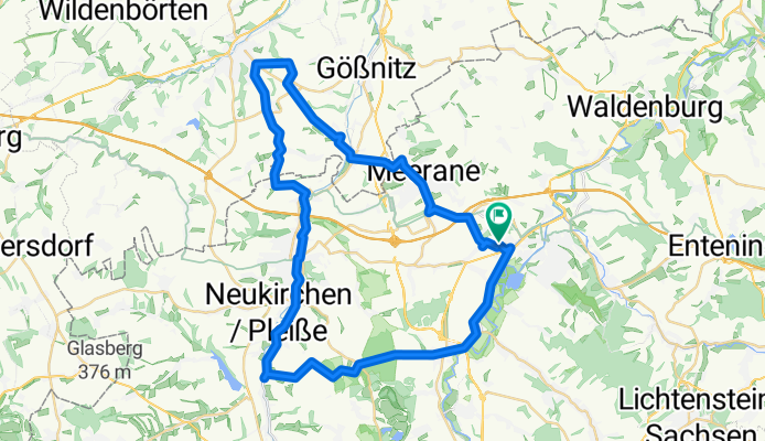
Overview
About this route
- 2 h 58 min
- Duration
- 48.8 km
- Distance
- 416 m
- Ascent
- 414 m
- Descent
- 16.5 km/h
- Avg. speed
- 336 m
- Max. altitude

Route quality
Waytypes & surfaces along the route
Waytypes
Quiet road
17.6 km
(36 %)
Road
13.7 km
(28 %)
Surfaces
Paved
34.2 km
(70 %)
Unpaved
5.9 km
(12 %)
Asphalt
33.2 km
(68 %)
Gravel
3.9 km
(8 %)
Continue with Bikemap
Use, edit, or download this cycling route
You would like to ride Mit Netti zum Fahren or customize it for your own trip? Here is what you can do with this Bikemap route:
Free features
- Save this route as favorite or in collections
- Copy & plan your own version of this route
- Sync your route with Garmin or Wahoo
Premium features
Free trial for 3 days, or one-time payment. More about Bikemap Premium.
- Navigate this route on iOS & Android
- Export a GPX / KML file of this route
- Create your custom printout (try it for free)
- Download this route for offline navigation
Discover more Premium features.
Get Bikemap PremiumFrom our community
Other popular routes starting in Glauchau
 Fichtelbergtour 2013
- Distance
- 185.4 km
- Ascent
- 1,731 m
- Descent
- 1,730 m
- Location
- Glauchau, Saxony, Germany
 BA-GL2 19 km über B180 Wüstenbr
- Distance
- 19 km
- Ascent
- 322 m
- Descent
- 224 m
- Location
- Glauchau, Saxony, Germany
 RBT Glauchau - Gera
- Distance
- 46.6 km
- Ascent
- 248 m
- Descent
- 294 m
- Location
- Glauchau, Saxony, Germany
 Fichtelbergrunde
- Distance
- 146.3 km
- Ascent
- 1,770 m
- Descent
- 1,673 m
- Location
- Glauchau, Saxony, Germany
 Brücke-bis-Karlsweg
- Distance
- 3.4 km
- Ascent
- 6 m
- Descent
- 9 m
- Location
- Glauchau, Saxony, Germany
 From Muelsen To Goessnitz
- Distance
- 16 km
- Ascent
- 66 m
- Descent
- 110 m
- Location
- Glauchau, Saxony, Germany
 BA-GL3 15 km üb Lobsd B180 Hohenst-Ernstt
- Distance
- 15.1 km
- Ascent
- 209 m
- Descent
- 146 m
- Location
- Glauchau, Saxony, Germany
 Mulderadweg - Abschnitt Glauchau bis Rochlitz (Zwickauer Mulde)
- Distance
- 44.2 km
- Ascent
- 453 m
- Descent
- 534 m
- Location
- Glauchau, Saxony, Germany
Open it in the app