
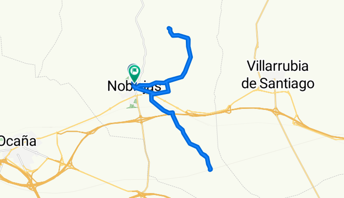
De Calle Pajareta a Calle Pajareta
A cycling route starting in Noblejas, Castille-La Mancha, Spain.
Overview
About this route
- 1 h 21 min
- Duration
- 21.1 km
- Distance
- 142 m
- Ascent
- 199 m
- Descent
- 15.5 km/h
- Avg. speed
- 800 m
- Max. altitude
Route photos


Route quality
Waytypes & surfaces along the route
Waytypes
Track
14.3 km
(68 %)
Quiet road
6.5 km
(31 %)
Cycleway
0.2 km
(1 %)
Surfaces
Paved
5.5 km
(26 %)
Asphalt
5.5 km
(26 %)
Undefined
15.6 km
(74 %)
Continue with Bikemap
Use, edit, or download this cycling route
You would like to ride De Calle Pajareta a Calle Pajareta or customize it for your own trip? Here is what you can do with this Bikemap route:
Free features
- Save this route as favorite or in collections
- Copy & plan your own version of this route
- Sync your route with Garmin or Wahoo
Premium features
Free trial for 3 days, or one-time payment. More about Bikemap Premium.
- Navigate this route on iOS & Android
- Export a GPX / KML file of this route
- Create your custom printout (try it for free)
- Download this route for offline navigation
Discover more Premium features.
Get Bikemap PremiumFrom our community
Other popular routes starting in Noblejas
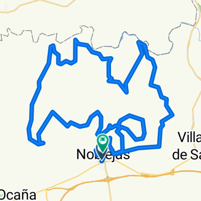 Mtb noblejas xtreme
- Distance
- 54.6 km
- Ascent
- 1,012 m
- Descent
- 998 m
- Location
- Noblejas, Castille-La Mancha, Spain
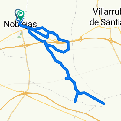 rutita wena!!
- Distance
- 30.8 km
- Ascent
- 160 m
- Descent
- 222 m
- Location
- Noblejas, Castille-La Mancha, Spain
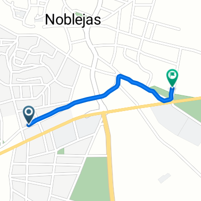 De Calle de Manuel Infantes, 10, Noblejas a Calle de Madrid, 1, Noblejas
- Distance
- 0.6 km
- Ascent
- 9 m
- Descent
- 0 m
- Location
- Noblejas, Castille-La Mancha, Spain
- De Calle Pajareta a Calle Pajareta
- Distance
- 21.1 km
- Ascent
- 142 m
- Descent
- 199 m
- Location
- Noblejas, Castille-La Mancha, Spain
Open it in the app