
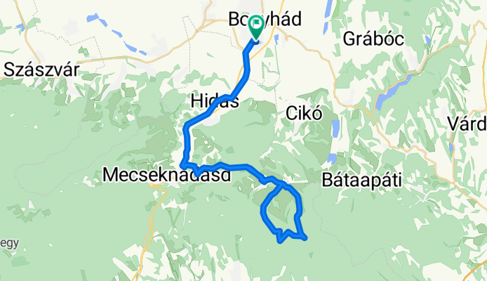
István utca, Bonyhád - István utca, Bonyhád
A cycling route starting in Bonyhád, Tolna County, Hungary.
Overview
About this route
- 2 h 17 min
- Duration
- 40.2 km
- Distance
- 528 m
- Ascent
- 526 m
- Descent
- 17.7 km/h
- Avg. speed
- 297 m
- Max. altitude
Route photos


Route quality
Waytypes & surfaces along the route
Waytypes
Road
10.5 km
(26 %)
Quiet road
9.6 km
(24 %)
Surfaces
Paved
31.4 km
(78 %)
Asphalt
31.4 km
(78 %)
Undefined
8.8 km
(22 %)
Continue with Bikemap
Use, edit, or download this cycling route
You would like to ride István utca, Bonyhád - István utca, Bonyhád or customize it for your own trip? Here is what you can do with this Bikemap route:
Free features
- Save this route as favorite or in collections
- Copy & plan your own version of this route
- Sync your route with Garmin or Wahoo
Premium features
Free trial for 3 days, or one-time payment. More about Bikemap Premium.
- Navigate this route on iOS & Android
- Export a GPX / KML file of this route
- Create your custom printout (try it for free)
- Download this route for offline navigation
Discover more Premium features.
Get Bikemap PremiumFrom our community
Other popular routes starting in Bonyhád
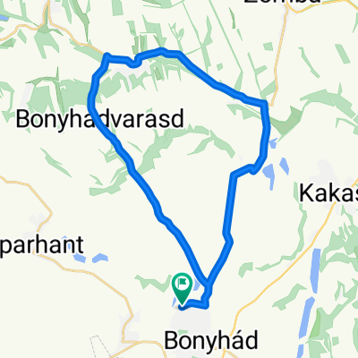
 Óbányai bringatúra
- Distance
- 78.9 km
- Ascent
- 621 m
- Descent
- 588 m
- Location
- Bonyhád, Tolna County, Hungary
 V. Szelidi-tó kerékpártúra
- Distance
- 152.4 km
- Ascent
- 305 m
- Descent
- 305 m
- Location
- Bonyhád, Tolna County, Hungary
 Szálka-Grábóc
- Distance
- 19.8 km
- Ascent
- 405 m
- Descent
- 405 m
- Location
- Bonyhád, Tolna County, Hungary
 Bonyhád-Kisdorog-Bonyhád
- Distance
- 27.3 km
- Ascent
- 243 m
- Descent
- 243 m
- Location
- Bonyhád, Tolna County, Hungary
 Bonyhád-Szecska halastó kerülés
- Distance
- 9.9 km
- Ascent
- 102 m
- Descent
- 94 m
- Location
- Bonyhád, Tolna County, Hungary
 Októberi nyolcas
- Distance
- 31.7 km
- Ascent
- 318 m
- Descent
- 318 m
- Location
- Bonyhád, Tolna County, Hungary
 Márton napi karika
- Distance
- 59 km
- Ascent
- 447 m
- Descent
- 447 m
- Location
- Bonyhád, Tolna County, Hungary
 Tolna
Tolna- Distance
- 19.8 km
- Ascent
- 132 m
- Descent
- 195 m
- Location
- Bonyhád, Tolna County, Hungary
Open it in the app