
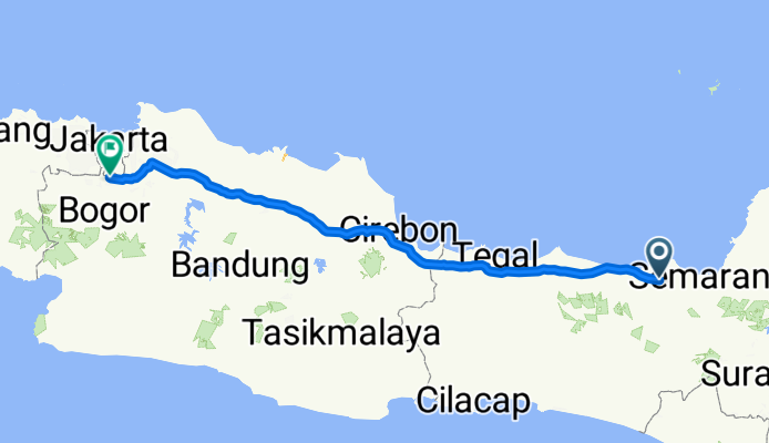
Jalan Tol Semarang–Batang, Kabupaten Kendal to Jalan Raya Margonda, Depok
A cycling route starting in Weleri, Central Java, Indonesia.
Overview
About this route
- 6 h 31 min
- Duration
- 405.1 km
- Distance
- 1,147 m
- Ascent
- 1,094 m
- Descent
- 62.2 km/h
- Avg. speed
- 116 m
- Max. altitude
Route photos


Continue with Bikemap
Use, edit, or download this cycling route
You would like to ride Jalan Tol Semarang–Batang, Kabupaten Kendal to Jalan Raya Margonda, Depok or customize it for your own trip? Here is what you can do with this Bikemap route:
Free features
- Save this route as favorite or in collections
- Copy & plan your own version of this route
- Split it into stages to create a multi-day tour
- Sync your route with Garmin or Wahoo
Premium features
Free trial for 3 days, or one-time payment. More about Bikemap Premium.
- Navigate this route on iOS & Android
- Export a GPX / KML file of this route
- Create your custom printout (try it for free)
- Download this route for offline navigation
Discover more Premium features.
Get Bikemap PremiumFrom our community
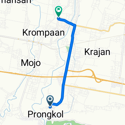
Other popular routes starting in Weleri
 Jalan Raya Pantura 17, Kecamatan Gringsing to Jalan Sentul Alas Roban Ds, Kecamatan Gringsing
- Distance
- 4.6 km
- Ascent
- 159 m
- Descent
- 65 m
- Location
- Weleri, Central Java, Indonesia
- Jalan Tol Semarang–Batang, Kabupaten Kendal to Jalan Raya Margonda, Depok
- Distance
- 405.1 km
- Ascent
- 1,147 m
- Descent
- 1,094 m
- Location
- Weleri, Central Java, Indonesia
 Jalan Raya Semarang - Batang No.17, Kecamatan Gringsing to Unnamed Road, Kecamatan Rowosari
- Distance
- 11.6 km
- Ascent
- 60 m
- Descent
- 91 m
- Location
- Weleri, Central Java, Indonesia
 Jalan Tol Semarang - Batang, Kecamatan Gringsing to Jalan Tol Semarang - Batang
- Distance
- 8.1 km
- Ascent
- 12 m
- Descent
- 41 m
- Location
- Weleri, Central Java, Indonesia
 X4WR+96C to Jalan Cepiring-Gemuh
- Distance
- 6.1 km
- Ascent
- 6 m
- Descent
- 36 m
- Location
- Weleri, Central Java, Indonesia
 23Q3+52V, Kecamatan Weleri to Jalan Bahari No.19, Kecamatan Weleri
- Distance
- 27 km
- Ascent
- 112 m
- Descent
- 115 m
- Location
- Weleri, Central Java, Indonesia
 Jalan Raya Semarang - Batang No.17, Kecamatan Gringsing to Unnamed Road, Kecamatan Rowosari
- Distance
- 12.7 km
- Ascent
- 282 m
- Descent
- 328 m
- Location
- Weleri, Central Java, Indonesia
 Route from Jalan Bendungan Juwero, Kecamatan Gemuh
- Distance
- 13.4 km
- Ascent
- 55 m
- Descent
- 94 m
- Location
- Weleri, Central Java, Indonesia
Open it in the app