
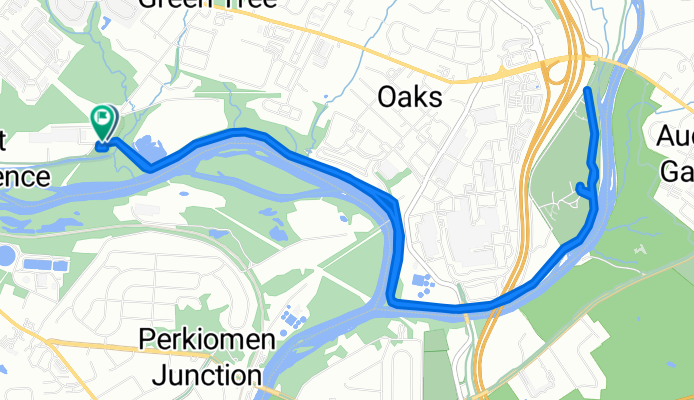
Longford Rd, Phoenixville to Longford Rd, Phoenixville
A cycling route starting in Phoenixville, Pennsylvania, United States.
Overview
About this route
- 42 min
- Duration
- 10.8 km
- Distance
- 39 m
- Ascent
- 40 m
- Descent
- 15.3 km/h
- Avg. speed
- 31 m
- Max. altitude

Route quality
Waytypes & surfaces along the route
Waytypes
Cycleway
8.7 km
(81 %)
Track
0.9 km
(8 %)
Surfaces
Paved
8.9 km
(83 %)
Paved (undefined)
8.8 km
(82 %)
Asphalt
0.1 km
(1 %)
Undefined
1.8 km
(17 %)
Continue with Bikemap
Use, edit, or download this cycling route
You would like to ride Longford Rd, Phoenixville to Longford Rd, Phoenixville or customize it for your own trip? Here is what you can do with this Bikemap route:
Free features
- Save this route as favorite or in collections
- Copy & plan your own version of this route
- Sync your route with Garmin or Wahoo
Premium features
Free trial for 3 days, or one-time payment. More about Bikemap Premium.
- Navigate this route on iOS & Android
- Export a GPX / KML file of this route
- Create your custom printout (try it for free)
- Download this route for offline navigation
Discover more Premium features.
Get Bikemap PremiumFrom our community
Other popular routes starting in Phoenixville
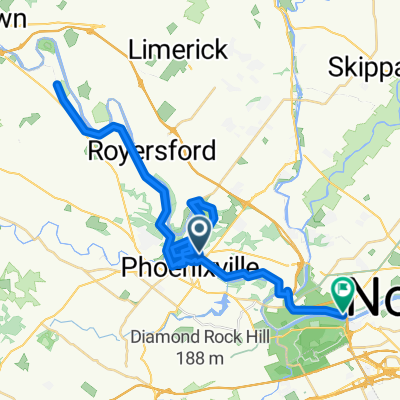
 160–178 Walnut St, Mont Clare to Sullivan Ln, Norristown
- Distance
- 9.3 km
- Ascent
- 35 m
- Descent
- 34 m
- Location
- Phoenixville, Pennsylvania, United States
 Longford Rd, Phoenixville to Longford Rd, Phoenixville
- Distance
- 10.8 km
- Ascent
- 39 m
- Descent
- 40 m
- Location
- Phoenixville, Pennsylvania, United States
 Phoenixville to Washington
- Distance
- 426.2 km
- Ascent
- 3,615 m
- Descent
- 3,667 m
- Location
- Phoenixville, Pennsylvania, United States
 bike tour through Upper Providence
- Distance
- 11.7 km
- Ascent
- 108 m
- Descent
- 90 m
- Location
- Phoenixville, Pennsylvania, United States
 Schwenksville
- Distance
- 20.7 km
- Ascent
- 93 m
- Descent
- 112 m
- Location
- Phoenixville, Pennsylvania, United States
 Home to work
- Distance
- 7.8 km
- Ascent
- 113 m
- Descent
- 102 m
- Location
- Phoenixville, Pennsylvania, United States
 Canal Park, Mont Clare to Schuylkill River Trail, King Of Prussia
- Distance
- 53.1 km
- Ascent
- 343 m
- Descent
- 339 m
- Location
- Phoenixville, Pennsylvania, United States
 Phoenixville - Washington
- Distance
- 302.4 km
- Ascent
- 2,002 m
- Descent
- 2,002 m
- Location
- Phoenixville, Pennsylvania, United States
Open it in the app