

Route in San Giovanni di Fassa
A cycling route starting in Mazzin, Trentino-Alto Adige, Italy.
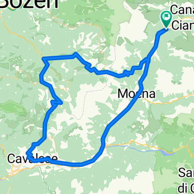
Overview
About this route
El ascenso en bicicleta al refugio Gardeccia, en el corazón del grupo del Catinaccio en los Dolomitas italianos, ofrece una experiencia tan exigente como fascinante. Rodeado por un entorno natural majestuoso, el paisaje que acompaña la subida está dominado por las imponentes agujas de piedra de las Torri di Vajolet, paredes verticales que parecen esculpidas con precisión. Los bosques de coníferas, los prados alpinos y las formaciones rocosas típicas de esta zona Patrimonio de la Humanidad conforman un escenario de alta montaña que cautiva tanto a los amantes de la naturaleza como a los ciclistas que se atreven con el reto.
- 49 min
- Duration
- 6.3 km
- Distance
- 656 m
- Ascent
- 55 m
- Descent
- 7.8 km/h
- Avg. speed
- 1,944 m
- Max. altitude

Route photos

Route quality
Waytypes & surfaces along the route
Waytypes
Quiet road
4.1 km
(65 %)
Road
2.1 km
(33 %)
Access road
0.1 km
(2 %)
Surfaces
Paved
2 km
(32 %)
Unpaved
0.1 km
(1 %)
Asphalt
2 km
(32 %)
Unpaved (undefined)
0.1 km
(1 %)
Undefined
4.2 km
(67 %)
Continue with Bikemap
Use, edit, or download this cycling route
You would like to ride Route in San Giovanni di Fassa or customize it for your own trip? Here is what you can do with this Bikemap route:
Free features
- Save this route as favorite or in collections
- Copy & plan your own version of this route
- Sync your route with Garmin or Wahoo
Premium features
Free trial for 3 days, or one-time payment. More about Bikemap Premium.
- Navigate this route on iOS & Android
- Export a GPX / KML file of this route
- Create your custom printout (try it for free)
- Download this route for offline navigation
Discover more Premium features.
Get Bikemap PremiumFrom our community
Other popular routes starting in Mazzin
 Alpy, den 4 (Sella - Gardena - Campolongo - Pordoi)
- Distance
- 74.1 km
- Ascent
- 2,053 m
- Descent
- 2,053 m
- Location
- Mazzin, Trentino-Alto Adige, Italy
 Alpy, den 3 (Pordoi - Falzarego - Valparola - Fedaia)
- Distance
- 102.5 km
- Ascent
- 2,621 m
- Descent
- 2,621 m
- Location
- Mazzin, Trentino-Alto Adige, Italy
 Alpy, den 2 (Pampeago - Costalunga)
- Distance
- 93.8 km
- Ascent
- 2,040 m
- Descent
- 2,040 m
- Location
- Mazzin, Trentino-Alto Adige, Italy
 Alpy, den 6 (Pordoi - Campolongo - Valparola - San Pellegrino)
- Distance
- 146.2 km
- Ascent
- 3,213 m
- Descent
- 3,213 m
- Location
- Mazzin, Trentino-Alto Adige, Italy
 Dolomity 2012 / den 2 / Pampeago
- Distance
- 86.5 km
- Ascent
- 1,847 m
- Descent
- 1,847 m
- Location
- Mazzin, Trentino-Alto Adige, Italy
 Transalp 2011 Tag 5
- Distance
- 83.1 km
- Ascent
- 1,844 m
- Descent
- 3,175 m
- Location
- Mazzin, Trentino-Alto Adige, Italy
 Sella-Runde (Startort Mazzin)
- Distance
- 76.4 km
- Ascent
- 2,075 m
- Descent
- 2,075 m
- Location
- Mazzin, Trentino-Alto Adige, Italy
 Alpy, den 5 - odpoledne (Sella)
- Distance
- 33.6 km
- Ascent
- 876 m
- Descent
- 873 m
- Location
- Mazzin, Trentino-Alto Adige, Italy
Open it in the app